
IMAGES TAKEN NEAR TO
Rhu Ellen Court, HELENSBURGH, G84 8SD
Introduction
This page details the photographs taken nearby to Rhu Ellen Court, G84 8SD by members of the Geograph project.
The Geograph project started in 2005 with the aim of publishing, organising and preserving representative images for every square kilometre of Great Britain, Ireland and the Isle of Man.

There are currently over 7.5m images from over14,400 individuals and you can help contribute to the project by visiting https://www.geograph.org.uk
Image Map
Images are licensed for reuse under creativecommons.org/licenses/by-sa/2.0
Notes
- Clicking on the map will re-center to the selected point.
- The higher the marker number, the further away the image location is from the centre of the postcode.
Image Listing (76 Images Found)
Images are licensed for reuse under creativecommons.org/licenses/by-sa/2.0
Image
Details
Distance
1
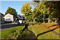
Burn beside Manse Brae
The road on the left is called Manse Brae. The footpath on the right is also a cycle path; not far ahead, it can be seen crossing the burn by means of a small bridge, as shown from another angle in Image
Image: © Lairich Rig
Taken: 15 Oct 2012
0.02 miles
2
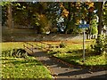
Regional Route 42
The cycle path is here shown crossing a Image
Image: © Lairich Rig
Taken: 15 Oct 2012
0.02 miles
3
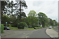
Watersedge Close junction with A814
The lay by is a bus stop
Image: © John Firth
Taken: 11 May 2012
0.02 miles
4
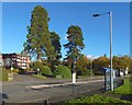
Rhu Ellen Court
The view is from beside the shore at Rhu.
Image: © Lairich Rig
Taken: 1 Nov 2016
0.03 miles
5
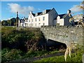
Burn flowing under the road at Rhu
As shown on the map, a burn flows under the road here; it passes under this bridge.
Image are in the background.
Image: © Lairich Rig
Taken: 1 Nov 2016
0.03 miles
6
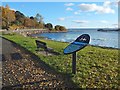
Interpretation panel by the shore at Rhu
Several panels like this one had recently been installed at points along the Clyde Sea Lochs Trail. The text on this one is about Rhu.
Rhu Marina can be seen in the background.
Image: © Lairich Rig
Taken: 1 Nov 2016
0.04 miles
8
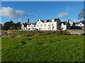
Beside the shore at Rhu
Image can be seen ahead. Behind the post office is Image
In the foreground are some metal covers; it is probably no coincidence that, as shown on the 1:25000 map, there is a pipe on the shore that heads away from this point. Behind them, the ground dips out of sight along the course of a burn that flows under the road here: Image
Image: © Lairich Rig
Taken: 1 Nov 2016
0.04 miles
9
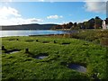
Beside the shore at Rhu
The area in the foreground is shown from another angle in Image The metal covers probably give access to a pipeline that continues on the shore, as indicated on the map. Rhu Post Office is at the far right, in the background.
Image: © Lairich Rig
Taken: 1 Nov 2016
0.04 miles
10
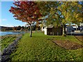
Beside the shore at Rhu
A toilet block is ahead. Behind and to the left of it is part of the post office: Image Between post office and toilet block is the area shown in Image, and a Image On the right is a pedestrian crossing at the foot of Manse Brae.
Image: © Lairich Rig
Taken: 1 Nov 2016
0.04 miles