IMAGES TAKEN NEAR TO
Baird Avenue, HELENSBURGH, G84 8DW
Introduction
This page details the photographs taken nearby to Baird Avenue, G84 8DW by members of the Geograph project.
The Geograph project started in 2005 with the aim of publishing, organising and preserving representative images for every square kilometre of Great Britain, Ireland and the Isle of Man.

There are currently over 7.5m images from over14,400 individuals and you can help contribute to the project by visiting https://www.geograph.org.uk
Image Map
Images are licensed for reuse under creativecommons.org/licenses/by-sa/2.0
Notes
- Clicking on the map will re-center to the selected point.
- The higher the marker number, the further away the image location is from the centre of the postcode.
Image Listing (39 Images Found)
Images are licensed for reuse under creativecommons.org/licenses/by-sa/2.0
Image
Details
Distance
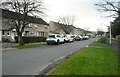
2
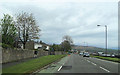
West King Street
Seen from the junction with Woodend Street.
Image: © Richard Sutcliffe
Taken: 27 Jan 2022
0.09 miles
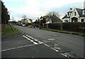
3
Restricted access
I don't know what access is restricted on this part of West Princes Street - it's not at all obvious.
Image: © Richard Sutcliffe
Taken: 27 Jan 2022
0.09 miles
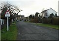
4
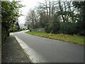
Camsail Avenue, Helensburgh
The photograph was taken from the junction with West Clyde Street / Rhu Road Lower (the street name changes at about that point). The short Camsail Avenue leads away from the photographer's position, and towards Ferniegair Avenue, which appears in the background.
Image: © Lairich Rig
Taken: 3 Jun 2011
0.11 miles
5
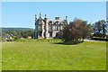
Cairndhu House
For an architectural description of this building, which is by William Leiper ( http://www.geograph.org.uk/snippet/5615 ), see its listed building report: http://portal.historic-scotland.gov.uk/designation/LB34847 (at Historic Environment Scotland).
See https://canmore.org.uk/site/197439/helensburgh-cairndhu-gardens-cairndhu-house (at Canmore) for further images, including some interior details.
For other views of this building on Geograph, and for further details of the uses to which it has been put, see Image and Image
Image: © Lairich Rig
Taken: 3 Jun 2011
0.13 miles
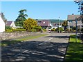
9
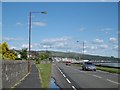
Rhu Road Lower
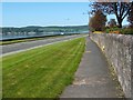
The photograph was taken from the junction with Image West Clyde Street becomes Rhu Road Lower at about that point. In the background, the Rosneath Peninsula can be seen on the other side of the Gare Loch.
For other views, see Image and Image
Image: © Lairich Rig
Taken: 3 Jun 2011
0.14 miles
10
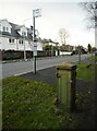
Old electricity junction box and bus stop
On West King Street. See Image for a closer view.
Image: © Richard Sutcliffe
Taken: 27 Jan 2022
0.14 miles