
IMAGES TAKEN NEAR TO
Woodcroft Gardens, ALEXANDRIA, G83 9JS
Introduction
This page details the photographs taken nearby to Woodcroft Gardens, G83 9JS by members of the Geograph project.
The Geograph project started in 2005 with the aim of publishing, organising and preserving representative images for every square kilometre of Great Britain, Ireland and the Isle of Man.

There are currently over 7.5m images from over14,400 individuals and you can help contribute to the project by visiting https://www.geograph.org.uk
Image Map
Images are licensed for reuse under creativecommons.org/licenses/by-sa/2.0
Notes
- Clicking on the map will re-center to the selected point.
- The higher the marker number, the further away the image location is from the centre of the postcode.
Image Listing (51 Images Found)
Images are licensed for reuse under creativecommons.org/licenses/by-sa/2.0
Image
Details
Distance
1
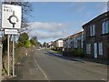
Entering Jamestown
John Neill's 1912 book "Records and Reminiscences of Bonhill Parish" offers, on page 43, an explanation for the name Jamestown. I cannot vouch for its correctness, but it is worth quoting here, for interest:
"In 1773 a schoolhouse was erected at Dam of Balloch, now called Jamestown, from the fact that three feuars whose individual Christian name was James, had each built a house there."
Image: © Lairich Rig
Taken: 15 Feb 2013
0.05 miles
2
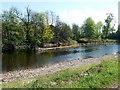
A skimmer in the River Leven
The stone structure shown at the centre of the photograph is more visible than usual after a period of dry weather, which had lowered the Leven's level. It is a "skimmer", directing some of the flow of the river into a lade. In this case, the lade served Dalmonach Print Works (for which, see Image).
For other examples on the River Leven, see Image and Image
Image: © Lairich Rig
Taken: 2 May 2011
0.10 miles
3
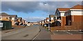
Levenbank
Levenbank is a housing development, built in the last few years on what had previously been the site of Image Behind the photographer's position, the former site of Image is now occupied by part of the same development (for other views of the now-demolished structures that used to be here, see Image and Image).
See also Image, a view from the other side of the river.
Image: © Lairich Rig
Taken: 6 Feb 2013
0.11 miles
4
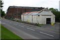
Bradleys Garage
Main Street Bonhill, Bradleys Garage, white building now demolished and Greigs Mill in background.
Image: © George Rankin
Taken: 4 Jun 2006
0.12 miles
5
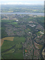
Vale of Leven and the River Clyde from the air
Most of the six mile length of the River Leven can be seen in this photo which was taken from a Glasgow bound flight from Newark USA.
Image: © Thomas Nugent
Taken: 15 Jul 2011
0.12 miles
6
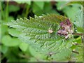
Leaf galls on nettle
These are caused by the gall midge species Dasineura urticae. They are pale green to purple, and have a slit-shaped opening (usually on the upper surface; see http://www.geograph.org.uk/photo/992628 for an example). When the photo was taken, this gall was very common on the nettles growing alongside the cycle route between Renton and Balloch.
For another common gall on nettles that is caused by a fungus rather than an insect, see: Image
Image: © Lairich Rig
Taken: 21 Sep 2008
0.12 miles
7
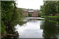
River Leven
View of the River Leven and Dalmonoch Works which has now been demolished
Image: © George Rankin
Taken: 4 Jun 2006
0.14 miles
8
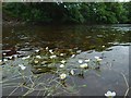
Water-crowfoot in the River Leven
(Ranunculus sp.)
The level of the river was low, making it easier to approach the plants, and causing the long stems to trail horizontally. The common name Water-crowfoot does not apply to just one species, but to several different ones that are superficially alike.
Image: © Lairich Rig
Taken: 22 Jun 2016
0.14 miles
9
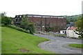
Greigs Mill
J & W Greig Ltd, Yarn Spinning Mills Dalmonach Works, Alexandria, Dunbartonshire
This used to a Wool and Yarn Mill and has now been knocked down to build Flats and Houses the white building used to be a Garage for many years.
Image: © George Rankin
Taken: 4 Jun 2006
0.15 miles
10
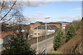
Gregs Mill
This is what was left of Dalmonoch Works Bonhill now demolished in late 2006 and soon will be a housing development
Image: © Eddie Mackinnon
Taken: 6 Mar 2005
0.16 miles