IMAGES TAKEN NEAR TO
Gilmour Street, ALEXANDRIA, G83 0DA

Introduction

This page details the photographs taken nearby to Gilmour Street, G83 0DA by members of the Geograph project.

The Geograph project started in 2005 with the aim of publishing, organising and preserving representative images for every square kilometre of Great Britain, Ireland and the Isle of Man.

There are currently over 7.5m images from over14,400 individuals and you can help contribute to the project by visiting https://www.geograph.org.uk

Image Map


Images are licensed for reuse under creativecommons.org/licenses/by-sa/2.0
Notes
  • Clicking on the map will re-center to the selected point.
  • The higher the marker number, the further away the image location is from the centre of the postcode.

Image Listing (131 Images Found)

Images are licensed for reuse under creativecommons.org/licenses/by-sa/2.0
  • ...
Image
Details
Distance
1
Middleton Street Alexandria
taken looking south at the junction of Gilmour street and Middleton street
Image: © Eddie Mackinnon Taken: 1 Apr 2006
0.02 miles
2
Gilmour Institute Alexandria
Gilmour Institute Alexandria now library
Image: © Eddie Mackinnon Taken: 3 Jul 2006
0.03 miles
3
Bench mark on the Gilmour Institute
For the whole building, see Image In relation to that picture, this bench mark is on the near left corner of the building, on the side of the corner that faces the street. I looked for this mark after consulting OS records, rather than noticing it by chance. According to the Ordnance Survey's own database, this is a 3rd-order cut bench mark, 22.450 metres above Newlyn Datum.
Image: © Lairich Rig Taken: 8 Jun 2018
0.03 miles
4
Gilmour Street Alexandria
Taken from Main Street
Image: © Eddie Mackinnon Taken: 11 Jul 2006
0.04 miles
5
Middleton Street in Alexandria
Looking north-westward.
Image: © Peter Wood Taken: 25 Jul 2020
0.04 miles
6
New mural in Alexandria
I took this picture a few minutes after photographing another by the same artist, Barry the Cat, a little further north on Main Street: Image Aside from the part covering a door on the left, the artwork is visible only when the shutters are down; my pictures of the murals were taken on a Sunday afternoon. The one in the present picture includes a depiction of Image, which is only about 50 metres to the north of the cafe.
Image: © Lairich Rig Taken: 11 Sep 2016
0.05 miles
7
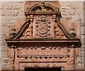
Masonic Temple: detail
See Image for the main description. The features shown in the present photograph are located above the main entrance. For a closer look at the carved foliage, see Image Click on the end-note title for other images of the building.
Image: © Lairich Rig Taken: 30 Nov 2010
0.05 miles
8
Masonic Temple: detail
See Image for the main description of the building as a whole, and Image for a wider view of the area in which the detail shown in the present photograph occurs. Around the foliage, it is possible to make out the vestiges of some lettering ("VALE", "[S]COTCH", "[GI]RLS" and "[S]OCIETY", referring to the Scotch Girls' Friendly Society); the building was originally designated an Institute for Working Girls, complementing the men-only Image nearby. Click on the end-note title for other pictures of the building.
Image: © Lairich Rig Taken: 30 Nov 2010
0.05 miles
9
Masonic Temple: detail
See Image for the main description, and for the whole building. The present picture shows details above the main entrance (on the southern side). At the top is the Gilmour crest and motto: "Nil penna sed usus" ("not the pen, but its use"); below that are details relating to use of the building as a Masonic Temple from 1921 onwards: "Lodge Bonhill and Alexandria St Andrew's Royal Arch 1826—1921 Masonic Temple № 321." Click on the end-note title for other pictures.
Image: © Lairich Rig Taken: 5 Apr 2013
0.05 miles
10
Main Street and B857 junction
Image: © John Firth Taken: 14 May 2014
0.05 miles
  • ...