Bench mark on the Gilmour Institute
Introduction
The photograph on this page of Bench mark on the Gilmour Institute by Lairich Rig as part of the Geograph project.
The Geograph project started in 2005 with the aim of publishing, organising and preserving representative images for every square kilometre of Great Britain, Ireland and the Isle of Man.

There are currently over 7.5m images from over 14,400 individuals and you can help contribute to the project by visiting https://www.geograph.org.uk
Bench mark on the Gilmour Institute
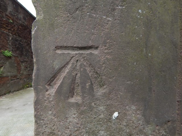
Image: © Lairich Rig Taken: 8 Jun 2018
For the whole building, see Image In relation to that picture, this bench mark is on the near left corner of the building, on the side of the corner that faces the street. I looked for this mark after consulting OS records, rather than noticing it by chance. According to the Ordnance Survey's own database, this is a 3rd-order cut bench mark, 22.450 metres above Newlyn Datum.
Images are licensed for reuse under creativecommons.org/licenses/by-sa/2.0
Image Location
Latitude
55.987218
Longitude
-4.582757