Masonic Temple: detail
Introduction
The photograph on this page of Masonic Temple: detail by Lairich Rig as part of the Geograph project.
The Geograph project started in 2005 with the aim of publishing, organising and preserving representative images for every square kilometre of Great Britain, Ireland and the Isle of Man.

There are currently over 7.5m images from over 14,400 individuals and you can help contribute to the project by visiting https://www.geograph.org.uk
Masonic Temple: detail
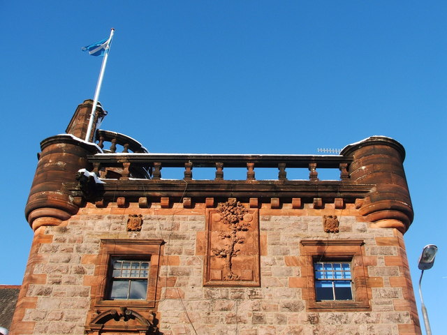
Image: © Lairich Rig Taken: 30 Nov 2010
See Image for the main description. The features shown in the present photograph are located above the main entrance. For a closer look at the carved foliage, see Image Click on the end-note title for other images of the building.
Images are licensed for reuse under creativecommons.org/licenses/by-sa/2.0
Image Location
Latitude
55.987085
Longitude
-4.584833