IMAGES TAKEN NEAR TO
Cardross, DUMBARTON, G82 5ET
Introduction
This page details the photographs taken nearby to G82 5ET by members of the Geograph project.
The Geograph project started in 2005 with the aim of publishing, organising and preserving representative images for every square kilometre of Great Britain, Ireland and the Isle of Man.

There are currently over 7.5m images from over14,400 individuals and you can help contribute to the project by visiting https://www.geograph.org.uk
Image Map
Images are licensed for reuse under creativecommons.org/licenses/by-sa/2.0
Notes
- Clicking on the map will re-center to the selected point.
- The higher the marker number, the further away the image location is from the centre of the postcode.
Image Listing (15 Images Found)
Images are licensed for reuse under creativecommons.org/licenses/by-sa/2.0
Image
Details
Distance
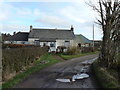
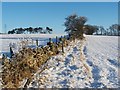
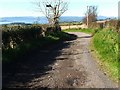
2
Track to High Milndovan Farm
The farm itself, which is shown in Image, is visible not far ahead, but is located in the adjacent grid square to the north.
See Image for a discussion of the area now occupied by High and Low Milndovan Farm, as depicted on various early maps.
Image: © Lairich Rig
Taken: 23 Dec 2010
0.06 miles
3
Track to High Milndovan
High Milndovan Farm is ahead: Image
Image: © Lairich Rig
Taken: 19 May 2017
0.06 miles
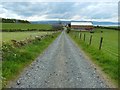
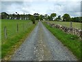
4
Farm track
The photograph was taken from the same spot as Image The track shown in the present photograph leads off to the right from that point.
Image: © Lairich Rig
Taken: 23 Dec 2010
0.07 miles
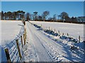
5
Dry-stone wall
This is a view from the field gate that is visible ahead in Image; the view direction for both photographs is the same.
These fields are associated with High Milndovan Farm (for which, see Image and Image).
Image: © Lairich Rig
Taken: 23 Dec 2010
0.08 miles
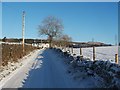
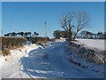
6
Track to Asker Farm
The track is shown in another season in Image
Image: © Lairich Rig
Taken: 19 May 2017
0.09 miles
7
A bend in the track
This is the same S-bend as shown in Image, but viewed in the opposite direction; the same tree is visible beside the track in both photographs.
For the view from the field gate that is visible ahead, see Image
Image: © Lairich Rig
Taken: 23 Dec 2010
0.09 miles
8
Track to Asker Farm
The photograph was taken at a point just north of Image From the photographer's position, another track leads off to the right: Image
For views from the point, visible ahead, where the track meets the edge of a strip of woodland, see Image and Image Also taken from there, on a different occasion, was Image, which is a view back down the same section of track.
Image: © Lairich Rig
Taken: 23 Dec 2010
0.10 miles
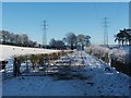
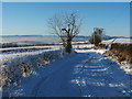
9
A bend in the track
There is an S-bend in the track at this point, between Image and Image (see also Image). For a similar but more wintry view, see Image
For a better view of the field that is visible just beyond the bend, see Image
The body of water visible in the background is the River Clyde.
Image: © Lairich Rig
Taken: 16 Oct 2009
0.11 miles
10
A bend in the track
This is the same view as Image, although captured in a different season.
For another view of this S-bend in the track, but looking in the opposite direction, see Image
Image: © Lairich Rig
Taken: 23 Dec 2010
0.11 miles