IMAGES TAKEN NEAR TO
Park Crescent, GLASGOW, G76 0JD
Introduction
This page details the photographs taken nearby to Park Crescent, G76 0JD by members of the Geograph project.
The Geograph project started in 2005 with the aim of publishing, organising and preserving representative images for every square kilometre of Great Britain, Ireland and the Isle of Man.

There are currently over 7.5m images from over14,400 individuals and you can help contribute to the project by visiting https://www.geograph.org.uk
Image Map
Images are licensed for reuse under creativecommons.org/licenses/by-sa/2.0
Notes
- Clicking on the map will re-center to the selected point.
- The higher the marker number, the further away the image location is from the centre of the postcode.
Image Listing (79 Images Found)
Images are licensed for reuse under creativecommons.org/licenses/by-sa/2.0
Image
Details
Distance
1
Polnoon Lodge
Polnoon Lodge was originally built as a hunting lodge in the early eighteenth century by Alexander, ninth Earl of Eglinton. Following the sale of the Eaglesham Estate in 1844 to Allan and James Gilmour, the lodge was used as the estate office for a short period of time. Later on Allan Gilmour's mother and sisters occupied the lodge for a time into the 1860s before being let. By the 1920s the lodge operated as a temperance hotel and later on as a boarding house. An annexe was used as a meeting room for local groups and societies. The lodge lay empty by the 1960s and was renovated by Renfrew County Council as housing for the elderly. The restoration work won a Civic Trust Award in 1971. One of the houses in Cheapside Street http://www.geograph.org.uk/photo/1484249 is a miniature of the lodge http://www.geograph.org.uk/photo/1643989 and was once occupied by the Eaglesham Estate factor. The Earls had another hunting lodge a few miles away at Cleughearn in East Kilbride Parish. Discover more about Polnoon Lodge and the history of Eaglesham by visiting the Geograph article, Eaglesham The Story of a Planned Village http://www.geograph.org.uk/article/Eaglesham-The-Story-of-a-Planned-Village.
Image: © Kenneth Mallard
Taken: 20 Aug 2009
0.09 miles
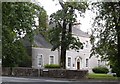
3
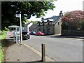
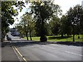
Toll House at the eastern entry to Eaglesham
Image: © Alan Reid
Taken: 29 Jun 2018
0.13 miles
5
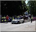
Eaglesham Fair 2009
The Fair Queen and Usher lead the procession to the common green for the crowning of the Queen and opening of the 2009 Eaglesham Fair. The carriage is drawn by a magnificent pair of Clydesdale horses driven by Jimmy Steel of Jackton. Alexander, the eighth Earl of Eglinton, obtained for the inhabitants a charter for a weekly market and an annual fair in 1672. The fair was held on the last Thursday in August when horse-races took place. Nowadays the fair is held bi-annually in June.
Image: © Kenneth Mallard
Taken: 30 May 2009
0.15 miles
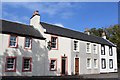
7
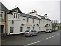
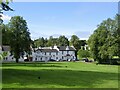
Eglinton Arms, Eaglesham
Hotel on Gilmour Street in Eaglesham.
Image: © G Laird
Taken: 3 Jan 2013
0.15 miles
8
Gilmour Street
This view looks along Gilmour Street to the crossroads. A corn mill once stood on the Orry http://www.geograph.org.uk/photo/1477760 where the white brick-built bus shelter can be seen in the distance. The Eaglesham Bi-centenary memorial stone http://www.geograph.org.uk/photo/1424812 is located behind the tree on the right-hand side foreground. Links to other views of Gilmour Street http://www.geograph.org.uk/photo/1484257 http://www.geograph.org.uk/photo/1450255 http://www.geograph.org.uk/photo/1484253 .
Image: © Kenneth Mallard
Taken: 12 Sep 2009
0.15 miles
9
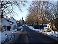
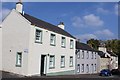
Cheapside Street
Cheapside Street looking towards the cross. The old Toll House http://www.geograph.org.uk/photo/1821577 can be seen on the right in the foreground. It was probably originally thatched.
Image: © Kenneth Mallard
Taken: 3 Jan 2010
0.15 miles