Cheapside Street
Introduction
The photograph on this page of Cheapside Street by Kenneth Mallard as part of the Geograph project.
The Geograph project started in 2005 with the aim of publishing, organising and preserving representative images for every square kilometre of Great Britain, Ireland and the Isle of Man.

There are currently over 7.5m images from over 14,400 individuals and you can help contribute to the project by visiting https://www.geograph.org.uk
Cheapside Street
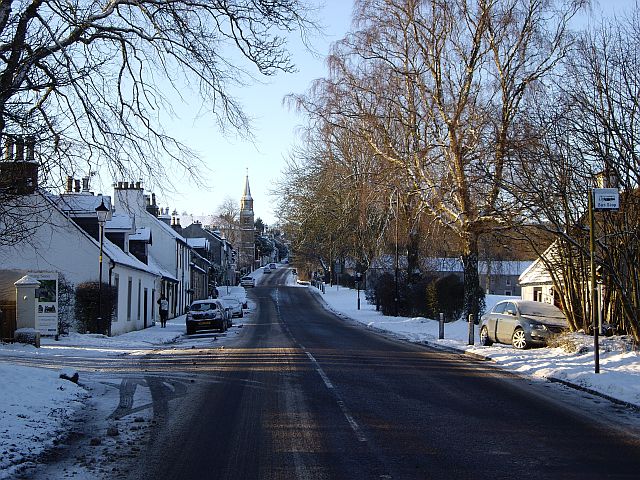
Image: © Kenneth Mallard Taken: 3 Jan 2010
Cheapside Street looking towards the cross. The old Toll House http://www.geograph.org.uk/photo/1821577 can be seen on the right in the foreground. It was probably originally thatched.
Images are licensed for reuse under creativecommons.org/licenses/by-sa/2.0
Image Location
Latitude
55.740447
Longitude
-4.271202