
IMAGES TAKEN NEAR TO
Castlecary Road, GLASGOW, G68 0HF
Introduction
This page details the photographs taken nearby to Castlecary Road, G68 0HF by members of the Geograph project.
The Geograph project started in 2005 with the aim of publishing, organising and preserving representative images for every square kilometre of Great Britain, Ireland and the Isle of Man.

There are currently over 7.5m images from over14,400 individuals and you can help contribute to the project by visiting https://www.geograph.org.uk
Image Map
Images are licensed for reuse under creativecommons.org/licenses/by-sa/2.0
Notes
- Clicking on the map will re-center to the selected point.
- The higher the marker number, the further away the image location is from the centre of the postcode.
Image Listing (66 Images Found)
Images are licensed for reuse under creativecommons.org/licenses/by-sa/2.0
Image
Details
Distance
1
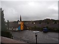
Castlecary House Hotel, view across car park
A very drab day (is there any other kind) in Castlecary.
Image: © coughlan
Taken: 30 Oct 2012
0.03 miles
2
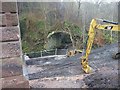
18th Century Bridge at Castlecarey
See also www.geograph.org.uk/photo/1617280
Image: © Texas Radio and The Big Beat
Taken: 13 Dec 2009
0.04 miles
3
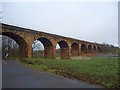
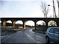
Castlecary, viaduct
Known to motorists driving on the M80 as 'Castlecary Arches' this impressive Victorian built structure has carried the main Glasgow-Edinburgh railway line over the Red Burn since 1842.
See RCAHMS record > http://canmore.rcahms.gov.uk/en/site/45861/details/castlecary+red+burn+railway+viaduct/
Image: © Robert Murray
Taken: 28 Jan 2012
0.05 miles
4
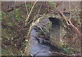
18th Century Bridge at Castlecary
C-listed bridge which crosses the Red Burn beneath Castlecary Viaduct.
Recently saved from the bulldozers, it was going to be demolished as
part of the A80 upgrading. The bridge is on the line of an old toll road.
Image: © Texas Radio and The Big Beat
Taken: 13 Dec 2009
0.06 miles
5
![Castlecary, Red Burn [2]](https://s2.geograph.org.uk/geophotos/02/78/61/2786126_a89f0a1b_120x120.jpg)
Castlecary, Red Burn [2]
The Red Burn as it emerges from its culvert underneath the M80. Much of this structure is new as a result of the motorway upgrade in 2008-11.
Image: © Robert Murray
Taken: 28 Jan 2012
0.08 miles
6
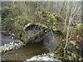
Castlecary, Red Burn
Showing view of remains of the Putlock bridge from the east.
See also Scotland's Places record http://www.scotlandsplaces.gov.uk/search_item/index.php?service=RCAHMS&id=106299
Image: © Robert Murray
Taken: 28 Jan 2012
0.08 miles
8
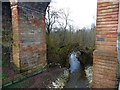
Castlecary, Red Burn through the arches
The old Putlock bridge can be seen arching over the Red Burn in the shadow of the railway viaduct.
Image: © Robert Murray
Taken: 28 Jan 2012
0.08 miles
10
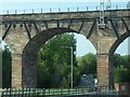
M80 nears railway viaduct at Castle Cary
Image: © Colin Pyle
Taken: 11 Jun 2015
0.09 miles