
IMAGES TAKEN NEAR TO
Glen Sannox Way, GLASGOW, G68 0GF
Introduction
This page details the photographs taken nearby to Glen Sannox Way, G68 0GF by members of the Geograph project.
The Geograph project started in 2005 with the aim of publishing, organising and preserving representative images for every square kilometre of Great Britain, Ireland and the Isle of Man.

There are currently over 7.5m images from over14,400 individuals and you can help contribute to the project by visiting https://www.geograph.org.uk
Image Map
Images are licensed for reuse under creativecommons.org/licenses/by-sa/2.0
Notes
- Clicking on the map will re-center to the selected point.
- The higher the marker number, the further away the image location is from the centre of the postcode.
Image Listing (12 Images Found)
Images are licensed for reuse under creativecommons.org/licenses/by-sa/2.0
Image
Details
Distance
1
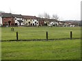
Glen Sannox View
Housing in Craigmarloch arranged about a public open space. The name is interesting as it is on a southward facing hillside suggesting that Arran is visible. It was cloudy so I could not test this.
Image: © Richard Webb
Taken: 4 Mar 2011
0.11 miles
2
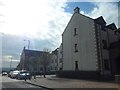
Flats on Glen Fyne Road
In Craigmarloch in Cumbernauld, just in front of Glen Orchy Drive.
Image: © Stephen Sweeney
Taken: 16 Apr 2014
0.14 miles
3
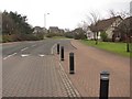
Glen Fyne Road
A loop road in Craigmarloch, Cumbernauld. Highland glens are used for street names here. This one is named after Glen Fyne in Argyll. Image
Image: © Richard Webb
Taken: 4 Mar 2011
0.15 miles
4
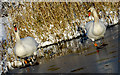
Craigmarloch Pond, Cumbernauld
Swans at Craigmarloch Pond, November 27 2010
Image: © Simon Walsh
Taken: 26 Nov 2010
0.19 miles
5
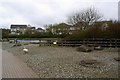
Craigmarloch Duck Pond
On Glen Fyne Road.
Image: © Texas Radio and The Big Beat
Taken: 18 Apr 2010
0.20 miles
6
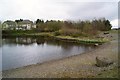
Craigmarloch Duck Pond
Image: © Texas Radio and The Big Beat
Taken: 18 Apr 2010
0.20 miles
7
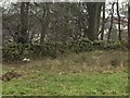
Stone Dyke road Craighalbert, Cumbernauld community park
this wall runs parallel to the modern 'snake' path of Cumbernauld community park. It could mark the position of the Auld Cley road and is certainly part of Craighalbert farm. Old farm buildings are being utilised as a school and residential buildings.
Image: © carrickstone emily
Taken: 6 Jan 2012
0.22 miles
8
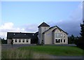
Craighalbert Church, Cumbernauld
Independent evangelical church. http://www.craighalbert.net/
Image: © Chris Upson
Taken: 19 Aug 2006
0.23 miles
9
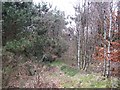
Woodland, Craigmarloch
A strip of woodland between two residential streets: Glen Dochart Drive and Glen Orchy Road.
Image: © Richard Webb
Taken: 4 Mar 2011
0.23 miles
10
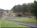
Woodland, Craighalbert
A largish open space in Cumbernauld. There are footpaths leading to underpasses at Craigmarloch Roundabout and maps tell of picnic places within the woods.
Image: © Richard Webb
Taken: 4 Mar 2011
0.23 miles