IMAGES TAKEN NEAR TO
Kilsyth, GLASGOW, G65 9LQ
Introduction
This page details the photographs taken nearby to G65 9LQ by members of the Geograph project.
The Geograph project started in 2005 with the aim of publishing, organising and preserving representative images for every square kilometre of Great Britain, Ireland and the Isle of Man.

There are currently over 7.5m images from over14,400 individuals and you can help contribute to the project by visiting https://www.geograph.org.uk
Image Map
Images are licensed for reuse under creativecommons.org/licenses/by-sa/2.0
Notes
- Clicking on the map will re-center to the selected point.
- The higher the marker number, the further away the image location is from the centre of the postcode.
Image Listing (17 Images Found)
Images are licensed for reuse under creativecommons.org/licenses/by-sa/2.0
Image
Details
Distance
1
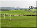
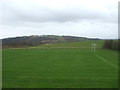
Mowing grass
Cutting grass for winter fodder, a view over the football park at Queenzieburn.
Image: © Richard Webb
Taken: 30 Sep 2011
0.10 miles
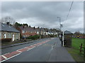
2
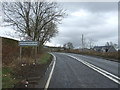
Entering Queenzieburn
Heading north east on Kilsyth Road (A803).
Image: © JThomas
Taken: 30 Mar 2017
0.12 miles
3
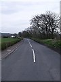
Queenzieburn to Twechar Road
This road runs across the Kelvin flood plain.
Queenzieburn is pronounced 'Queenieburn' as local patois dictates the dropping of a Z in placenames.
Image: © Robert Murray
Taken: 24 Apr 2010
0.16 miles
5
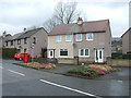
Mill Road, Queenzieburn
Showing position of Postbox No. G65 277.
See Image] for postbox.
Image: © JThomas
Taken: 30 Mar 2017
0.18 miles
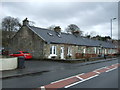
7
Bus stop and shelter on Kilsyth Road (A803), Queenzieburn
Image: © JThomas
Taken: 30 Mar 2017
0.19 miles
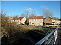
9
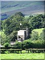
Old sewage treatment works, near Queenzieburn
And that's an American Confederate flag flying.
Image: © Robert Murray
Taken: 25 Aug 2010
0.20 miles
10
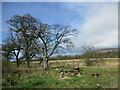
Trees on the boundary of farmland and open ground, Gavell
Image: © Alan O'Dowd
Taken: 27 Mar 2021
0.21 miles