IMAGES TAKEN NEAR TO
Station Lofts, GLASGOW, G63 9BD
Introduction
This page details the photographs taken nearby to Station Lofts, G63 9BD by members of the Geograph project.
The Geograph project started in 2005 with the aim of publishing, organising and preserving representative images for every square kilometre of Great Britain, Ireland and the Isle of Man.

There are currently over 7.5m images from over14,400 individuals and you can help contribute to the project by visiting https://www.geograph.org.uk
Image Map (Loading...)


Getting Data...Please wait
Leaflet Map data © OpenStreetMap
Images are licensed for reuse under creativecommons.org/licenses/by-sa/2.0
Notes
- Clicking on the map will re-center to the selected point.
- The higher the marker number, the further away the image location is from the centre of the postcode.
Image Listing (100 Images Found)
Images are licensed for reuse under creativecommons.org/licenses/by-sa/2.0
Image
Details
Distance
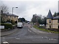
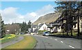
2
Glasgow Road, Strathblane
From the junction shown in Image, the John Muir Way follows Glasgow Road northwards. About 80 metres ahead of the point from which the present picture was taken, the route turns right (east) to follow Image
Image: © Lairich Rig
Taken: 18 Apr 2014
0.02 miles

5
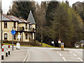
Strathblane, Glasgow Road
The A81, Glasgow Road, approaching its junction with the A891, Strathblane Road.
Image: © David Dixon
Taken: 20 Apr 2012
0.03 miles
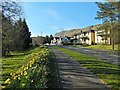
6
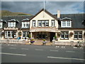
Kirkhouse Inn, Strathblane
at the Campsie Fells
Image: © william craig
Taken: 24 May 2005
0.04 miles
8
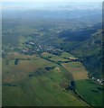
Strathblane and Loch Lomond from the air
Dunglass Hill is in the foreground to the left of the disused Blane Valley Railway which ran from Lennoxtown to Aberfoyle. See this http://www.railbrit.co.uk/Blane_Valley_Railway/frame.htm for more information about that line. Strathblane and Blanefield are in the centre, Campsie Fells to the right and Loch Lomond in the distance.
Viewed from a Glasgow Airport bound Boeing 747.
Image: © Thomas Nugent
Taken: 30 Jul 2007
0.05 miles
9
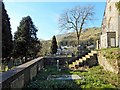
Strathblane Cemetery
The cemetery is next to the kirkyard of Image, and communicates with it by means of steps. See Image for a view in the opposite direction.
Image: © Lairich Rig
Taken: 20 Jun 2014
0.05 miles
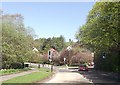
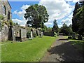
10
Strathblane Parish Kirkyard
This enclosure is to the south-west of the church (for which, see Image), and contains stones commemorating various members of the Miller-Stirling family.
Image: © Lairich Rig
Taken: 18 Apr 2014
0.05 miles