Strathblane and Loch Lomond from the air
Introduction
The photograph on this page of Strathblane and Loch Lomond from the air by Thomas Nugent as part of the Geograph project.
The Geograph project started in 2005 with the aim of publishing, organising and preserving representative images for every square kilometre of Great Britain, Ireland and the Isle of Man.

There are currently over 7.5m images from over 14,400 individuals and you can help contribute to the project by visiting https://www.geograph.org.uk
Strathblane and Loch Lomond from the air
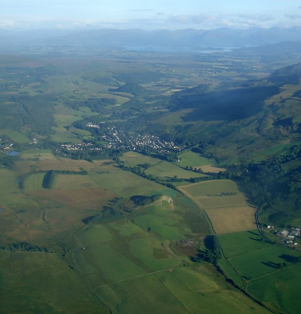
Image: © Thomas Nugent Taken: 30 Jul 2007
Dunglass Hill is in the foreground to the left of the disused Blane Valley Railway which ran from Lennoxtown to Aberfoyle. See this http://www.railbrit.co.uk/Blane_Valley_Railway/frame.htm for more information about that line. Strathblane and Blanefield are in the centre, Campsie Fells to the right and Loch Lomond in the distance. Viewed from a Glasgow Airport bound Boeing 747.
Images are licensed for reuse under creativecommons.org/licenses/by-sa/2.0
Image Location
Latitude
55.985376
Longitude
-4.303984