IMAGES TAKEN NEAR TO
Roman Gardens, GLASGOW, G61 2QN
Introduction
This page details the photographs taken nearby to Roman Gardens, G61 2QN by members of the Geograph project.
The Geograph project started in 2005 with the aim of publishing, organising and preserving representative images for every square kilometre of Great Britain, Ireland and the Isle of Man.

There are currently over 7.5m images from over14,400 individuals and you can help contribute to the project by visiting https://www.geograph.org.uk
Image Map
Images are licensed for reuse under creativecommons.org/licenses/by-sa/2.0
Notes
- Clicking on the map will re-center to the selected point.
- The higher the marker number, the further away the image location is from the centre of the postcode.
Image Listing (170 Images Found)
Images are licensed for reuse under creativecommons.org/licenses/by-sa/2.0
Image
Details
Distance
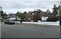
1
Roman Gardens
A cul-de-sac off Roman Drive.
Image: © Richard Sutcliffe
Taken: 30 Aug 2021
0.01 miles
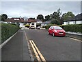
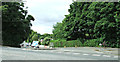
3
Roman Drive, Hillfoot
Appropriately named Bearsden street. The line of the Antonine Wall runs about 200m to the west (extreme left of image).
Image: © Richard Sutcliffe
Taken: 22 Dec 2017
0.04 miles
4
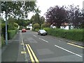
Roman Avenue
A cul-de-sac off Roman Drive.
Image: © Richard Sutcliffe
Taken: 30 Aug 2021
0.05 miles
5
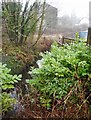
The Manse Burn
The burn (behind the Laurel bushes) runs between the railway line and houses on Roman Drive.
Image: © Richard Sutcliffe
Taken: 22 Dec 2017
0.07 miles
6
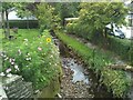
The Manse Burn
Seen from Roman Drive. Cosmos and sunflowers are in flower beside it.
Image: © Richard Sutcliffe
Taken: 30 Aug 2021
0.07 miles
7
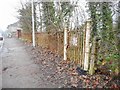
Rusty gate and railings, Hillfoot
Beside the footpath adjacent to the A81, approaching the bridge over the railway.
Image: © Richard Sutcliffe
Taken: 22 Dec 2017
0.08 miles
8
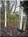
Rusty gate, Hillfoot
Beside the footpath adjacent to the A81.
Image: © Richard Sutcliffe
Taken: 22 Dec 2017
0.08 miles
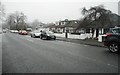
9
Roman Drive
Looking towards the site of Antonine Wall which was the northern limit http://www.antoninewall.org/fre.php of the Roman Empire.
Image: © Thomas Nugent
Taken: 10 Aug 2013
0.08 miles
10
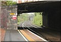
Under Milngavie Road
The view from Hillfoot Station, looking along the railway lines towards Bearsden. The Roman Road bridge is in the distance.
Image: © Richard Sutcliffe
Taken: 15 May 2015
0.09 miles