
IMAGES TAKEN NEAR TO
Eagle Street, GLASGOW, G4 9XA
Introduction
This page details the photographs taken nearby to Eagle Street, G4 9XA by members of the Geograph project.
The Geograph project started in 2005 with the aim of publishing, organising and preserving representative images for every square kilometre of Great Britain, Ireland and the Isle of Man.

There are currently over 7.5m images from over14,400 individuals and you can help contribute to the project by visiting https://www.geograph.org.uk
Image Map
Images are licensed for reuse under creativecommons.org/licenses/by-sa/2.0
Notes
- Clicking on the map will re-center to the selected point.
- The higher the marker number, the further away the image location is from the centre of the postcode.
Image Listing (168 Images Found)
Images are licensed for reuse under creativecommons.org/licenses/by-sa/2.0
Image
Details
Distance
1
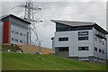
Business park
This is Craighall Business Park, some parts of it are still under construction while the two units in this picture are finished and await occupants.
Image: © Paul McIlroy
Taken: 13 Jul 2007
0.14 miles
2
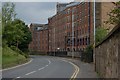
Craighall Road
The building on the right of the picture is a former grain mill. Image
Image: © Paul McIlroy
Taken: 13 Jul 2007
0.14 miles
3
![Forth and Clyde Canal [9]](https://s3.geograph.org.uk/geophotos/06/24/49/6244955_d6ae1cde_120x120.jpg)
Forth and Clyde Canal [9]
Seen across the canal, the pylon carries the supply to the Spiers Wharf sub-station feeding the industry at Port Dundas.
The Forth and Clyde Canal was completed in 1790 and it provided a route for vessels between the Firth of Forth and the Firth of Clyde at the narrowest part (35 miles, 56km) of the Scottish Lowlands. Closed in 1963, the canal became semi-derelict. Millennium funds were used to regenerate the canal. The Glasgow Branch of the canal is a Scheduled Monument with details at: http://portal.historicenvironment.scot/designation/SM6771
Image: © Michael Dibb
Taken: 25 Jun 2019
0.15 miles
4
![Glasgow buildings [8]](https://s0.geograph.org.uk/geophotos/06/24/49/6244956_2a5661eb_120x120.jpg)
Glasgow buildings [8]
The Whisky Bond Building was originally built as a bonded warehouse for Highland Distilleries in 1957. Converted in 2012 it now offers studio space and facilities and is home to a community of creative businesses and start-ups.
Image: © Michael Dibb
Taken: 25 Jun 2019
0.15 miles
5
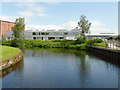
National Theatre of Scotland, Craighall Road
These premises by the canal are the company offices rather than a performance space.
Image: © Stephen Craven
Taken: 25 Jun 2019
0.16 miles
6
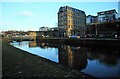
Wheatsheaf Building
Late afternoon sunshine on the Category C listed http://portal.historicenvironment.scot/designation/LB44112 Wheatsheaf Building, a former sugar refinery warehouse, now offices. To the left is one of the World War II stop locks, to be used in the event of the canal being breached by enemy bombs. If needed, these stop locks would have limited any flooding which occurred. They were never needed. This one has recently got a new lease of life, being used as the basis for a new pedestrian bridge across the canal.
Image: © Richard Sutcliffe
Taken: 9 Dec 2022
0.16 miles
7

Wheatsheaf Building
Category C listed http://portal.historicenvironment.scot/designation/LB44112 Wheatsheaf Building, a former sugar refinery warehouse, now offices, beside the Forth and Clyde Canal.
Image: © Richard Sutcliffe
Taken: 9 Dec 2022
0.16 miles
8
![Glasgow buildings [7]](https://s2.geograph.org.uk/geophotos/06/24/49/6244954_3b5bac23_120x120.jpg)
Glasgow buildings [7]
Now converted into offices, the Wheatsheaf Building was built as a warehouse for the sugar refinery Image The mansard attic is a modern addition. Built in 1866, the building is listed, category C, with details at: http://portal.historicenvironment.scot/designation/LB44112
Image: © Michael Dibb
Taken: 25 Jun 2019
0.17 miles
9
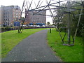
Slightly diverted towpath
The path alongside the Forth and Clyde Canal close to Spiers Wharf has been diverted from its original line to accommodate an electricity pylon.
Image: © Mark Nightingale
Taken: 30 Sep 2009
0.17 miles
10
Speirs Wharf, The Glasgow Branch of The Forth and Clyde Canal
Image: © habiloid
Taken: 30 Jul 2021
0.17 miles