
Wheatsheaf Building
Introduction
The photograph on this page of Wheatsheaf Building by Richard Sutcliffe as part of the Geograph project.
The Geograph project started in 2005 with the aim of publishing, organising and preserving representative images for every square kilometre of Great Britain, Ireland and the Isle of Man.

There are currently over 7.5m images from over 14,400 individuals and you can help contribute to the project by visiting https://www.geograph.org.uk
Wheatsheaf Building
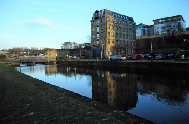
Image: © Richard Sutcliffe Taken: 9 Dec 2022
Late afternoon sunshine on the Category C listed http://portal.historicenvironment.scot/designation/LB44112 Wheatsheaf Building, a former sugar refinery warehouse, now offices. To the left is one of the World War II stop locks, to be used in the event of the canal being breached by enemy bombs. If needed, these stop locks would have limited any flooding which occurred. They were never needed. This one has recently got a new lease of life, being used as the basis for a new pedestrian bridge across the canal.
Images are licensed for reuse under creativecommons.org/licenses/by-sa/2.0
Image Location

Latitude
55.874525
Longitude
-4.257446