
IMAGES TAKEN NEAR TO
Fergus Court, GLASGOW, G20 6AR
Introduction
This page details the photographs taken nearby to Fergus Court, G20 6AR by members of the Geograph project.
The Geograph project started in 2005 with the aim of publishing, organising and preserving representative images for every square kilometre of Great Britain, Ireland and the Isle of Man.

There are currently over 7.5m images from over14,400 individuals and you can help contribute to the project by visiting https://www.geograph.org.uk
Image Map
Images are licensed for reuse under creativecommons.org/licenses/by-sa/2.0
Notes
- Clicking on the map will re-center to the selected point.
- The higher the marker number, the further away the image location is from the centre of the postcode.
Image Listing (118 Images Found)
Images are licensed for reuse under creativecommons.org/licenses/by-sa/2.0
Image
Details
Distance
1
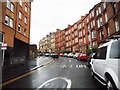
Oban Drive
Looking up the one-way street from Queen Margaret Drive.
Image: © Richard Sutcliffe
Taken: 3 Sep 2017
0.08 miles
2
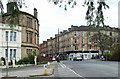
Queen Margaret Drive
At the junction with Kelvin Drive.
Image: © Thomas Nugent
Taken: 20 Oct 2007
0.11 miles
3
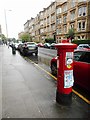
Queen Margaret Drive
Yellow sandstone tenements on the western side of the road. The George V pillar box is postbox number G20 436.
Image: © Richard Sutcliffe
Taken: 3 Sep 2017
0.12 miles
4
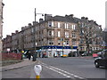
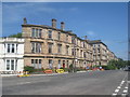
Queen Margaret Drive from near Queen Bridge
The junction with Fergus Drive and Kelvinside Gardens on the right, and Kelvin Drive joining from the left.
Image: © M J Richardson
Taken: 3 Mar 2012
0.12 miles
6
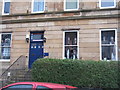
Watchers at the windows
At the corner of Clouston Street and Queen Margaret Drive.
Image: © M J Richardson
Taken: 3 Mar 2012
0.14 miles
7
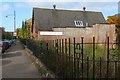
North Kelvinside Parish Church
This is a view along Kelbourne Street, from its junction with Queen Margaret Drive.
The previous church building occupied the corner (the grassy space in front of the present building), but has now been demolished; see https://canmore.org.uk/site/168496/glasgow-queen-margaret-drive-north-kelvinside-church (at Canmore) for a photograph of it. The present-day building was its church hall, and stands on the site of a "mission hall", probably the same building, that is shown on OS maps from 1895, and which therefore pre-dates the now-demolished church.
Image: © Lairich Rig
Taken: 11 Oct 2010
0.14 miles
8
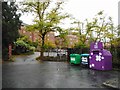
Recycling bins at the end of Kelvinside Drive
Recycling facilities for glass, paper and clothing at the end of the public road. The roadway continues to a parking area for flats which face onto Oban Drive.
Image: © Richard Sutcliffe
Taken: 3 Sep 2017
0.14 miles
9
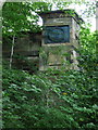
Old bridge parapet
What appears to be the remains of an old road bridge, just east of the bridge at Queen Margaret Drive Image
Image: © Thomas Nugent
Taken: 12 Jul 2008
0.14 miles
10
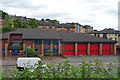
Maryhill Fire Station
The fire station is on Maryhill Road, and is viewed here from the canal towpath.
Image: © Anne Burgess
Taken: 25 Jun 2019
0.15 miles