North Kelvinside Parish Church
Introduction
The photograph on this page of North Kelvinside Parish Church by Lairich Rig as part of the Geograph project.
The Geograph project started in 2005 with the aim of publishing, organising and preserving representative images for every square kilometre of Great Britain, Ireland and the Isle of Man.

There are currently over 7.5m images from over 14,400 individuals and you can help contribute to the project by visiting https://www.geograph.org.uk
North Kelvinside Parish Church
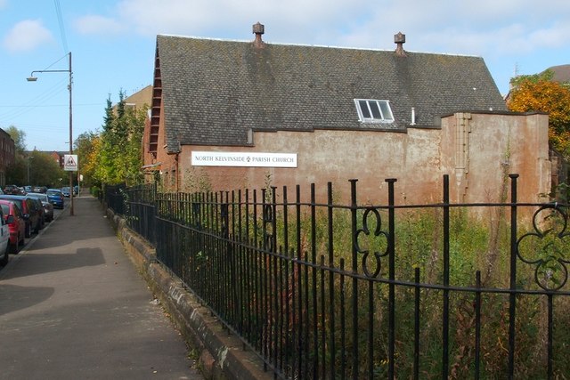
Image: © Lairich Rig Taken: 11 Oct 2010
This is a view along Kelbourne Street, from its junction with Queen Margaret Drive. The previous church building occupied the corner (the grassy space in front of the present building), but has now been demolished; see https://canmore.org.uk/site/168496/glasgow-queen-margaret-drive-north-kelvinside-church (at Canmore) for a photograph of it. The present-day building was its church hall, and stands on the site of a "mission hall", probably the same building, that is shown on OS maps from 1895, and which therefore pre-dates the now-demolished church.
Images are licensed for reuse under creativecommons.org/licenses/by-sa/2.0
Image Location
Latitude
55.881678
Longitude
-4.283764