IMAGES TAKEN NEAR TO
Allan Crescent, DENNY, FK6 6LZ
Introduction
This page details the photographs taken nearby to Allan Crescent, FK6 6LZ by members of the Geograph project.
The Geograph project started in 2005 with the aim of publishing, organising and preserving representative images for every square kilometre of Great Britain, Ireland and the Isle of Man.

There are currently over 7.5m images from over14,400 individuals and you can help contribute to the project by visiting https://www.geograph.org.uk
Image Map (Loading...)


Getting Data...Please wait
Leaflet Map data © OpenStreetMap
Images are licensed for reuse under creativecommons.org/licenses/by-sa/2.0
Notes
- Clicking on the map will re-center to the selected point.
- The higher the marker number, the further away the image location is from the centre of the postcode.
Image Listing (25 Images Found)
Images are licensed for reuse under creativecommons.org/licenses/by-sa/2.0
Image
Details
Distance
1
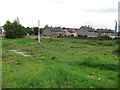
Site of a building, Dunipace
The pipes suggest that there was once a petrol station here on Stirling Street.
Image: © Richard Webb
Taken: 10 Sep 2011
0.07 miles
2
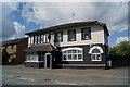
The Anchor Inn, Dunipace
Image: © Texas Radio and The Big Beat
Taken: 27 Aug 2010
0.08 miles
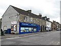
4
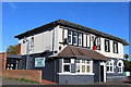
The Songbird Bar & Function Suite, Dunipace
Image: © Leslie Barrie
Taken: 10 Oct 2013
0.09 miles
8
Mural beneath former railway bridge
The bridge itself is shown in Image
For the choice of subject matter, see the end-note. The text at the right-hand end, with an arrow, indicates the destination of the path in that direction, and reads "Dunipace".
Accompanying the artwork on the facing wall is the following text: "This mural was created in partnership with the Community Green Initiative and the Community Safety Fund"; compare Image, which is located along the same route.
Image: © Lairich Rig
Taken: 19 Apr 2010
0.13 miles
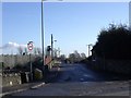
9
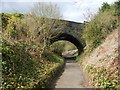
Bridge over the Old Railway Line Path
The bridge carries a road over this footpath, but, like Image, it would originally have led the road over a railway line. The last-mentioned bridge has a mural beneath it (Image); there is also one beneath the bridge shown in the present photograph: Image
On the far side of the bridge, the lower end of a grey, gravelly path can be seen; this path leads up to the pavement beside the main road (Stirling Street).
Image: © Lairich Rig
Taken: 19 Apr 2010
0.13 miles
10
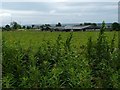
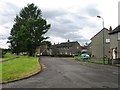
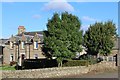
Bankend Farm
The photo was taken from a footpath between Stirling Street and Plean Road. The old School House (compare Image) is visible to the left of the farm.
Image: © Lairich Rig
Taken: 5 Jul 2008
0.14 miles