Bridge over the Old Railway Line Path
Introduction
The photograph on this page of Bridge over the Old Railway Line Path by Lairich Rig as part of the Geograph project.
The Geograph project started in 2005 with the aim of publishing, organising and preserving representative images for every square kilometre of Great Britain, Ireland and the Isle of Man.

There are currently over 7.5m images from over 14,400 individuals and you can help contribute to the project by visiting https://www.geograph.org.uk
Bridge over the Old Railway Line Path
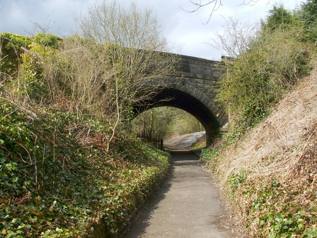
Image: © Lairich Rig Taken: 19 Apr 2010
The bridge carries a road over this footpath, but, like Image, it would originally have led the road over a railway line. The last-mentioned bridge has a mural beneath it (Image); there is also one beneath the bridge shown in the present photograph: Image On the far side of the bridge, the lower end of a grey, gravelly path can be seen; this path leads up to the pavement beside the main road (Stirling Street).
Images are licensed for reuse under creativecommons.org/licenses/by-sa/2.0
Image Location
Latitude
56.031127
Longitude
-3.914919