Mural beneath former railway bridge
Introduction
The photograph on this page of Mural beneath former railway bridge by Lairich Rig as part of the Geograph project.
The Geograph project started in 2005 with the aim of publishing, organising and preserving representative images for every square kilometre of Great Britain, Ireland and the Isle of Man.

There are currently over 7.5m images from over 14,400 individuals and you can help contribute to the project by visiting https://www.geograph.org.uk
Mural beneath former railway bridge
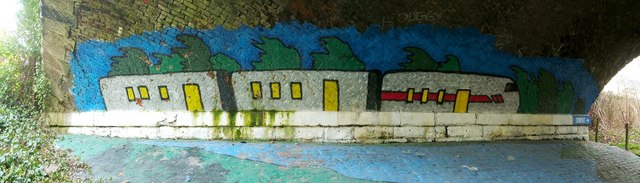
Image: © Lairich Rig Taken: 19 Apr 2010
The bridge itself is shown in Image For the choice of subject matter, see the end-note. The text at the right-hand end, with an arrow, indicates the destination of the path in that direction, and reads "Dunipace". Accompanying the artwork on the facing wall is the following text: "This mural was created in partnership with the Community Green Initiative and the Community Safety Fund"; compare Image, which is located along the same route.
Images are licensed for reuse under creativecommons.org/licenses/by-sa/2.0
Image Location
Latitude
56.031127
Longitude
-3.914919