
IMAGES TAKEN NEAR TO
Kinnell, KILLIN, FK21 8SR
Introduction
This page details the photographs taken nearby to FK21 8SR by members of the Geograph project.
The Geograph project started in 2005 with the aim of publishing, organising and preserving representative images for every square kilometre of Great Britain, Ireland and the Isle of Man.

There are currently over 7.5m images from over14,400 individuals and you can help contribute to the project by visiting https://www.geograph.org.uk
Image Map
Images are licensed for reuse under creativecommons.org/licenses/by-sa/2.0
Notes
- Clicking on the map will re-center to the selected point.
- The higher the marker number, the further away the image location is from the centre of the postcode.
Image Listing (14 Images Found)
Images are licensed for reuse under creativecommons.org/licenses/by-sa/2.0
Image
Details
Distance
1
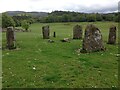
Kinnell Stone Circle
https://killin.info/guide/kinnell-stone-circle/
Kinnell Stone Circle stands around 100m from Kinnell on the South bank of the river Dochart in a private grazing field. The circle is thought to date from the 2nd or 3rd Millennium BC.
The stone circle stands in private actively used farm land. There may be livestock within the fields and appropriate respect should be adhered to when visiting the area. Ideally please check with the land owner before entering the field.
Image: © thejackrustles
Taken: 24 May 2016
0.09 miles
3
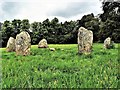
Kinnell Stone Circle - Killin
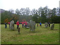
There are six stones in the ling and they are arranged on the circumference of a flattened circle measuring 9.5m by 8.5m in diameter. Unlike some other circles, the stones are not graded in height but the two tallest stones (up to 2m high) lie adjacent to each other on the south-west quadrant and they are flanked on the north and east by the two shortest stones (1.2m high). On the top of the northernmost stone there are three plain cup-marks: this is a rather unusual place to find them as they are normally to be seen on the flat faces of standing stones.
Canmore https://canmore.org.uk/site/24189/killin-kinnell-park
Image: © Raibeart MacAoidh
Taken: 22 Jun 2019
0.09 miles
4
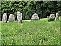
Kinnell Stone Circle - Killin
There are six stones in the ling and they are arranged on the circumference of a flattened circle measuring 9.5m by 8.5m in diameter. Unlike some other circles, the stones are not graded in height but the two tallest stones (up to 2m high) lie adjacent to each other on the south-west quadrant and they are flanked on the north and east by the two shortest stones (1.2m high). On the top of the northernmost stone there are three plain cup-marks: this is a rather unusual place to find them as they are normally to be seen on the flat faces of standing stones.
Canmore https://canmore.org.uk/site/24189/killin-kinnell-park
Image: © Raibeart MacAoidh
Taken: 22 Jun 2019
0.09 miles
5
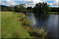
River Dochart, Killin
The River Dochart downstream from Killin just before it flows into Loch Tay.
Image: © Philip Halling
Taken: 4 Aug 2008
0.15 miles
6
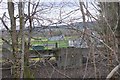
Sewage works, Killin
Treatment works between the village and Loch Tay.
Image: © Jim Barton
Taken: 7 Mar 2019
0.22 miles
7
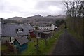
Killin Branch trackbed
Passing Killin to the east with a view of the Tarmachan ridge.
Image: © Richard Webb
Taken: 28 Apr 2017
0.22 miles
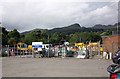
9
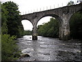
Old Railway Bridge over the River Dochart
Image: © Iain Lees
Taken: 10 Jul 2008
0.23 miles
10
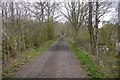
Killin Branch trackbed
The railway passed Killin on a high embankment.
Image: © Richard Webb
Taken: 28 Apr 2017
0.23 miles