Kinnell Stone Circle - Killin
Introduction
The photograph on this page of Kinnell Stone Circle - Killin by Raibeart MacAoidh as part of the Geograph project.
The Geograph project started in 2005 with the aim of publishing, organising and preserving representative images for every square kilometre of Great Britain, Ireland and the Isle of Man.

There are currently over 7.5m images from over 14,400 individuals and you can help contribute to the project by visiting https://www.geograph.org.uk
Kinnell Stone Circle - Killin
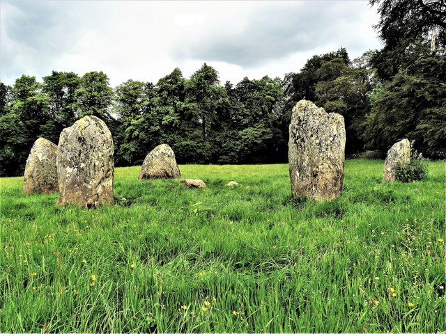
Image: © Raibeart MacAoidh Taken: 22 Jun 2019
There are six stones in the ling and they are arranged on the circumference of a flattened circle measuring 9.5m by 8.5m in diameter. Unlike some other circles, the stones are not graded in height but the two tallest stones (up to 2m high) lie adjacent to each other on the south-west quadrant and they are flanked on the north and east by the two shortest stones (1.2m high). On the top of the northernmost stone there are three plain cup-marks: this is a rather unusual place to find them as they are normally to be seen on the flat faces of standing stones. Canmore https://canmore.org.uk/site/24189/killin-kinnell-park
Images are licensed for reuse under creativecommons.org/licenses/by-sa/2.0
Image Location
Latitude
56.465782
Longitude
-4.311255