Kinnell Stone Circle
Introduction
The photograph on this page of Kinnell Stone Circle by thejackrustles as part of the Geograph project.
The Geograph project started in 2005 with the aim of publishing, organising and preserving representative images for every square kilometre of Great Britain, Ireland and the Isle of Man.

There are currently over 7.5m images from over 14,400 individuals and you can help contribute to the project by visiting https://www.geograph.org.uk
Kinnell Stone Circle
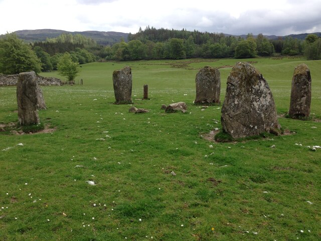
Image: © thejackrustles Taken: 24 May 2016
https://killin.info/guide/kinnell-stone-circle/ Kinnell Stone Circle stands around 100m from Kinnell on the South bank of the river Dochart in a private grazing field. The circle is thought to date from the 2nd or 3rd Millennium BC. The stone circle stands in private actively used farm land. There may be livestock within the fields and appropriate respect should be adhered to when visiting the area. Ideally please check with the land owner before entering the field.
Images are licensed for reuse under creativecommons.org/licenses/by-sa/2.0
Image Location
Latitude
56.465808
Longitude
-4.311306