
IMAGES TAKEN NEAR TO
Hittisleigh, EXETER, EX6 6LG
Introduction
This page details the photographs taken nearby to EX6 6LG by members of the Geograph project.
The Geograph project started in 2005 with the aim of publishing, organising and preserving representative images for every square kilometre of Great Britain, Ireland and the Isle of Man.

There are currently over 7.5m images from over14,400 individuals and you can help contribute to the project by visiting https://www.geograph.org.uk
Image Map
Images are licensed for reuse under creativecommons.org/licenses/by-sa/2.0
Notes
- Clicking on the map will re-center to the selected point.
- The higher the marker number, the further away the image location is from the centre of the postcode.
Image Listing (15 Images Found)
Images are licensed for reuse under creativecommons.org/licenses/by-sa/2.0
Image
Details
Distance
1
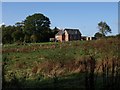
Converted chapel, Hittisleigh
The Wesleyan Methodist chapel was built in 1903. Seen across a field from the stretch of the Two Moors Way shown in Image
Image: © Derek Harper
Taken: 17 Oct 2009
0.00 miles
2
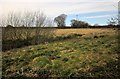
Field, Hittisleigh
From Newhouse Lane on the Two Moors Way, with what looks like the source of one of the headwaters of a tributary of the River Yeo a few metres away. Across the field is a hedge bordering the lane to Whiddon Down.
Image: © Derek Harper
Taken: 10 Mar 2015
0.06 miles
3
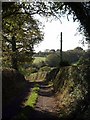
Newhouse Lane, Hittisleigh
The Two Moors Way uses Hittisleigh Footpath 4 south of the village, following this lane towards Image, but first descending here to cross a tributary of the Yeo.
Image: © Derek Harper
Taken: 17 Oct 2009
0.07 miles
4
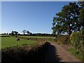
Lane near Hittisleigh
A reverse view of Image, looking back up the lane towards Whiddon Down, and taken from the same spot as Image
Image: © Derek Harper
Taken: 17 Oct 2009
0.08 miles
5
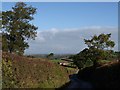
Approaching Hittisleigh
The lane from Whiddon Down makes a sharp descent on the ridge it has been following. The bungalow is on a farm lane to Midlake. Just visible on the right is Image
Image: © Derek Harper
Taken: 17 Oct 2009
0.09 miles
6
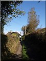
Newhouse Lane approaching Hittisleigh
Looking in the other direction from Image, with the thatched Grove Cottage where the lane carrying the Two Moors Way reaches the main lane into the village. http://www.imagesofengland.org.uk/details/default.aspx?id=445095
Image: © Derek Harper
Taken: 17 Oct 2009
0.09 miles
7
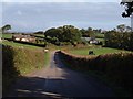
Approaching Hittisleigh
Taken a little further down the lane shown in Image The group of buildings forms a separate southwest part of the scattered village; Image, visible right of centre, is over 700 metres beyond them.
Image: © Derek Harper
Taken: 17 Oct 2009
0.11 miles
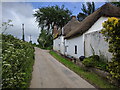
9
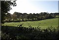
Sheep at Hittisleigh
Sheep in the northern part of an irregularly-shaped field just southwest of the village, the one on the right of Image (the photo was taken from the corner by the trees on the right).
Image: © Derek Harper
Taken: 17 Oct 2009
0.13 miles
10
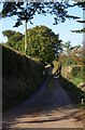
Parsonage Lane, Hittisleigh
Looking along the no through road that leads to .. The Parsonage, and to Crayford, from Image
Image: © Derek Harper
Taken: 17 Oct 2009
0.14 miles