IMAGES TAKEN NEAR TO
TORRINGTON, EX38 7EY

Introduction

This page details the photographs taken nearby to EX38 7EY by members of the Geograph project.

The Geograph project started in 2005 with the aim of publishing, organising and preserving representative images for every square kilometre of Great Britain, Ireland and the Isle of Man.

There are currently over 7.5m images from over14,400 individuals and you can help contribute to the project by visiting https://www.geograph.org.uk

Image Map


Images are licensed for reuse under creativecommons.org/licenses/by-sa/2.0
Notes
  • Clicking on the map will re-center to the selected point.
  • The higher the marker number, the further away the image location is from the centre of the postcode.

Image Listing (23 Images Found)

Images are licensed for reuse under creativecommons.org/licenses/by-sa/2.0
  • ...
Image
Details
Distance
1
Great Torrington : Country Road
A road heading out from Great Torrington.
Image: © Lewis Clarke Taken: 4 Dec 2019
0.02 miles
2
Great Torrington : Abandoned Site
Derelict buildings in Great Torrington.
Image: © Lewis Clarke Taken: 4 Dec 2019
0.02 miles
3
Old Milestone north of Great Torrington
Carved stone post by the UC road, in parish of GREAT TORRINGTON (TORRIDGE District), Tanton's Plain, 200m North of road constriction, opposite path into woods, where the stream takes a right angle, on East side of road. Barum tombstone, erected by the Barnstaple turnpike trust in the 19th century. Inscription reads:- 14 BARUM BY BIDEFORD Carved benchmark on mid right side. Milestone Society National ID: DV_BSBB14.
Image: © A Rosevear Taken: 6 Feb 2012
0.10 miles
4
Great Torrington : Derelict Site
Derelict buildings in Great Torrington.
Image: © Lewis Clarke Taken: 4 Dec 2019
0.12 miles
5
Great Torrington : Derelict Site
Derelict buildings in Great Torrington.
Image: © Lewis Clarke Taken: 4 Dec 2019
0.13 miles
6
Lane, Great Torrington Common
Looking the other way from Image], with the access land of the common on the right. The premises of PDM Torrington shown in Image] extend off to the left down to the next entry turning where the for sale sign is.
Image: © Derek Harper Taken: 1 Dec 2019
0.14 miles
7
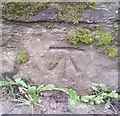
Ordnance Survey Cut Mark
This OS cut mark can be found on the SE parapet of the bridge on School Lane. It marks a point 49.999m above mean sea level.
Image: © Adrian Dust Taken: 5 Dec 2019
0.15 miles
8
Road to Great Torrington
Looking left from Image The road runs through the access land of Great Torrington Common, at first on the left, and from the bend on both sides.
Image: © Derek Harper Taken: 1 Dec 2019
0.15 miles
9
Great Torrington : Country Road
The road at the junction.
Image: © Lewis Clarke Taken: 4 Dec 2019
0.15 miles
10
Crossroads, north of Great Torrington
Image: © Roger Cornfoot Taken: 10 Aug 2021
0.16 miles
  • ...