Old Milestone north of Great Torrington
Introduction
The photograph on this page of Old Milestone north of Great Torrington by A Rosevear as part of the Geograph project.
The Geograph project started in 2005 with the aim of publishing, organising and preserving representative images for every square kilometre of Great Britain, Ireland and the Isle of Man.

There are currently over 7.5m images from over 14,400 individuals and you can help contribute to the project by visiting https://www.geograph.org.uk
Old Milestone north of Great Torrington
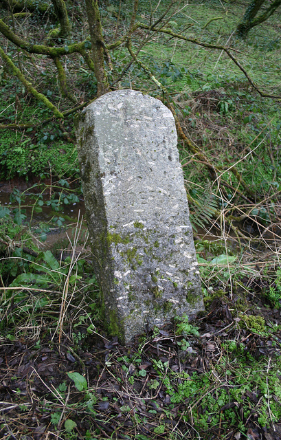
Image: © A Rosevear Taken: 6 Feb 2012
Carved stone post by the UC road, in parish of GREAT TORRINGTON (TORRIDGE District), Tanton's Plain, 200m North of road constriction, opposite path into woods, where the stream takes a right angle, on East side of road. Barum tombstone, erected by the Barnstaple turnpike trust in the 19th century. Inscription reads:- 14 BARUM BY BIDEFORD Carved benchmark on mid right side. Milestone Society National ID: DV_BSBB14.
Images are licensed for reuse under creativecommons.org/licenses/by-sa/2.0
Image Location
Latitude
50.959298
Longitude
-4.146151