IMAGES TAKEN NEAR TO
Fore Street, EXETER, EX3 0HU
Introduction
This page details the photographs taken nearby to Fore Street, EX3 0HU by members of the Geograph project.
The Geograph project started in 2005 with the aim of publishing, organising and preserving representative images for every square kilometre of Great Britain, Ireland and the Isle of Man.

There are currently over 7.5m images from over14,400 individuals and you can help contribute to the project by visiting https://www.geograph.org.uk
Image Map
Images are licensed for reuse under creativecommons.org/licenses/by-sa/2.0
Notes
- Clicking on the map will re-center to the selected point.
- The higher the marker number, the further away the image location is from the centre of the postcode.
Image Listing (605 Images Found)
Images are licensed for reuse under creativecommons.org/licenses/by-sa/2.0
Image
Details
Distance

3

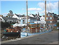
Fore Street, Topsham
This is near the junction (at the end) with Holman Way.
The restaurant in the foreground is called The Galley, keeping up the nautical theme of the town.
Image: © mike smith
Taken: 15 Apr 2012
0.01 miles
4
Topsham: The Devon Air Ambulance Trust
Image: © Michael Garlick
Taken: 16 Aug 2015
0.01 miles
5
Grade II listed Raleigh Hall, Topsham
Dated 1892, the single-storey brick building near the southern end of Fore Street was Grade II listed in 1974.
Image: © Jaggery
Taken: 30 Aug 2016
0.01 miles
6
![The Lighter Inn, Topsham [1]](https://s0.geograph.org.uk/geophotos/01/30/25/1302552_d25d0bd5_120x120.jpg)
The Lighter Inn, Topsham [1]
The Lighter Inn was formerly the Customs House and Harbour Master's Office and dates from the late 17th century.
The King's Beam in front of the inn is the customs weighbridge and probably dates from the 18th century.
Image: © Robin Drayton
Taken: 9 May 2009
0.01 miles

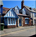
8
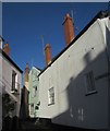
White Street, Topsham
Leading off from Fore Street.
Image: © M J Richardson
Taken: 12 Jan 2015
0.01 miles
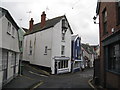
9
White Street, Topsham
From its junction with Fore Street. All buildings shown are listed. On the right is 40, Fore Street https://www.historicengland.org.uk/listing/the-list/list-entry/1103946 , succeeded by the gabled 38 White Street https://www.historicengland.org.uk/listing/the-list/list-entry/1224304 . On the left is 39 White Street https://www.historicengland.org.uk/listing/the-list/list-entry/1170338 .
Image: © Derek Harper
Taken: 3 Jun 2017
0.01 miles
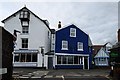
10
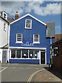
The Galley - fish restaurant, Topsham
A popular restaurant that was closed due to the Covid-19 pandemic. The grammar of Covid-19 is interesting in that scientifically it is COVID-19 but the newspapers have adopted the convention of only capitalising the first letter of an acronym that is pronounced as a word (FBI is fine but it's Covid-19).
Image: © Chris Allen
Taken: 6 May 2021
0.01 miles