The Lighter Inn, Topsham [1]
Introduction
The photograph on this page of The Lighter Inn, Topsham [1] by Robin Drayton as part of the Geograph project.
The Geograph project started in 2005 with the aim of publishing, organising and preserving representative images for every square kilometre of Great Britain, Ireland and the Isle of Man.

There are currently over 7.5m images from over 14,400 individuals and you can help contribute to the project by visiting https://www.geograph.org.uk
The Lighter Inn, Topsham [1]
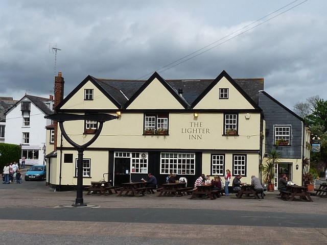
Image: © Robin Drayton Taken: 9 May 2009
The Lighter Inn was formerly the Customs House and Harbour Master's Office and dates from the late 17th century. The King's Beam in front of the inn is the customs weighbridge and probably dates from the 18th century.
Images are licensed for reuse under creativecommons.org/licenses/by-sa/2.0
Image Location


Leaflet Map data © OpenStreetMap
Latitude
50.681456
Longitude
-3.464501