
IMAGES TAKEN NEAR TO
Laburnum Road, EXETER, EX2 6EG
Introduction
This page details the photographs taken nearby to Laburnum Road, EX2 6EG by members of the Geograph project.
The Geograph project started in 2005 with the aim of publishing, organising and preserving representative images for every square kilometre of Great Britain, Ireland and the Isle of Man.

There are currently over 7.5m images from over14,400 individuals and you can help contribute to the project by visiting https://www.geograph.org.uk
Image Map
Images are licensed for reuse under creativecommons.org/licenses/by-sa/2.0
Notes
- Clicking on the map will re-center to the selected point.
- The higher the marker number, the further away the image location is from the centre of the postcode.
Image Listing (92 Images Found)
Images are licensed for reuse under creativecommons.org/licenses/by-sa/2.0
Image
Details
Distance
2
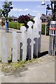
Abstract sculpture, Holly Road, Exeter
The roads around here are designated as a family friendly zone; since the houses are on a rectangular grid, trees, sculpture and roundabouts have been added to slow traffic and enhance the environment
Image: © David Smith
Taken: 5 Jul 2017
0.03 miles
3
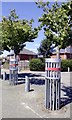
Protected trees, Holly Road. Exeter
The roads around here are designated as a family friendly zone; since the houses are on a rectangular grid, trees, sculpture and roundabouts have been added to slow traffic and enhance the environment
Image: © David Smith
Taken: 5 Jul 2017
0.04 miles
5
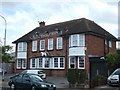
The Dolphin Inn, Burnthouse Lane
Another view of the pub is at Image It is curious that the name is the dolphin, but the statue on the front is of a dog.
Image: © David Smith
Taken: 11 Sep 2010
0.09 miles
6
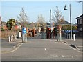
Wonford Home Zone
Traffic calming to make the residential road more friendly for children, elderly people and everybody
Image: © David Smith
Taken: 20 Mar 2011
0.09 miles
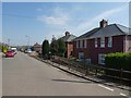
8
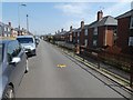
Chestnut Avenue, Exeter (3)
The estate is on the edge of a valley, so the houses are at different levels from the road
Image: © David Smith
Taken: 11 Apr 2020
0.10 miles
9
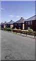
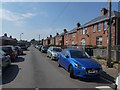
Chestnut Avenue, part of the Burnthouse Land housing estate
The area was developed as council housing when Exeter cleared its slums
Image: © David Smith
Taken: 5 Jul 2017
0.10 miles
10
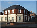
Former shop in Burnthouse Lane
The inscription over the door reads "J Rice" and over the window to the right is the word "Fruiterer".
Image: © David Smith
Taken: 20 Mar 2011
0.10 miles