
IMAGES TAKEN NEAR TO
Copplestone, CREDITON, EX17 5NX
Introduction
This page details the photographs taken nearby to EX17 5NX by members of the Geograph project.
The Geograph project started in 2005 with the aim of publishing, organising and preserving representative images for every square kilometre of Great Britain, Ireland and the Isle of Man.

There are currently over 7.5m images from over14,400 individuals and you can help contribute to the project by visiting https://www.geograph.org.uk
Image Map
Images are licensed for reuse under creativecommons.org/licenses/by-sa/2.0
Notes
- Clicking on the map will re-center to the selected point.
- The higher the marker number, the further away the image location is from the centre of the postcode.
Image Listing (22 Images Found)
Images are licensed for reuse under creativecommons.org/licenses/by-sa/2.0
Image
Details
Distance
1
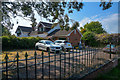
Copplestone : Higher Davidsland
Looking towards Higher Davidsland beyond the gate.
Image: © Lewis Clarke
Taken: 4 May 2020
0.00 miles
2
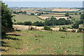
Crediton Hamlets: footpath to Davidsland Farm
Looking north-north-west. Davisland is out of shot and the farmhouse in mid-distance is Ash Bullayne. A 'Bull in Field' warning notice was tacked to the fence bordering the immediate field although there was no bull to be seen
Image: © Martin Bodman
Taken: 3 Aug 2006
0.00 miles
3
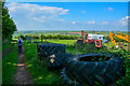
Copplestone : Footpath
A footpath heads beside some tyres at Higher Davidsland.
Image: © Lewis Clarke
Taken: 4 May 2020
0.03 miles
4
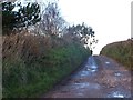
Lane and footpath off Bewsley Hill
The lane leads to Higher Davidsland and continues as a footpath along field boundaries to the Ash Brook (where it stops on a farm track)
Image: © David Smith
Taken: 10 Feb 2014
0.05 miles
5

Copplestone : Countryside Scenery
Looking out across the Mid Devon countryside.
Image: © Lewis Clarke
Taken: 4 May 2020
0.05 miles
6
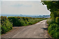
Copplestone : Country Lane
A country lane heading through the Copplestone parish.
Image: © Lewis Clarke
Taken: 4 May 2020
0.05 miles
8
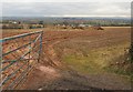
Field at Higher Davidsland
Looking through a gateway on Bewsley Hill, the lane from Elston Cross to Copplestone. Some manure waiting to be distributed. The new housing in the distance, on the east side of the village, is in Image
Image: © Derek Harper
Taken: 6 Mar 2010
0.08 miles
9
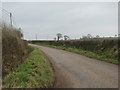
Minor road north-east of Copplestone
Image: © Sarah Charlesworth
Taken: 27 Jan 2010
0.09 miles
10
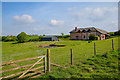
Copplestone : Higher Davidsland
Looking towards Higher Davidsland.
Image: © Lewis Clarke
Taken: 4 May 2020
0.09 miles