
IMAGES TAKEN NEAR TO
Cart Land Rise, EXETER, EX1 3YT
Introduction
This page details the photographs taken nearby to Cart Land Rise, EX1 3YT by members of the Geograph project.
The Geograph project started in 2005 with the aim of publishing, organising and preserving representative images for every square kilometre of Great Britain, Ireland and the Isle of Man.

There are currently over 7.5m images from over14,400 individuals and you can help contribute to the project by visiting https://www.geograph.org.uk
Image Map
Images are licensed for reuse under creativecommons.org/licenses/by-sa/2.0
Notes
- Clicking on the map will re-center to the selected point.
- The higher the marker number, the further away the image location is from the centre of the postcode.
Image Listing (72 Images Found)
Images are licensed for reuse under creativecommons.org/licenses/by-sa/2.0
Image
Details
Distance
1

Housing development north of Blackhorse Lane
New roads are being constructed as part of the Minerva site Image
Image: © David Smith
Taken: 22 May 2020
0.05 miles
2

The west end of housing development at Tithe Barn, Pinhoe
In the foreground is a spoil heap from landscaping the farmland. Together with Image] and Image] this gives a panorama of the construction site
Image: © David Smith
Taken: 5 Jan 2022
0.06 miles
3
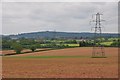
East Devon : Countryside Scenery
Looking across the countryside of East Devon.
Image: © Lewis Clarke
Taken: 30 May 2013
0.07 miles
4
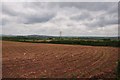
East Devon : Ploughed Field
A ploughed field off of Blackhorse Lane in East Devon.
Image: © Lewis Clarke
Taken: 30 May 2013
0.09 miles

6
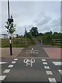
Modern form of distance indication, Exeter Science Park
Cyclists are told that this crossing is 4 miles from Exeter and (in the opposite direction) 2 miles from Cranbrook
Image: © David Smith
Taken: 22 May 2020
0.11 miles
7
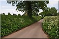
East Devon : Blackhorse Lane
Blackhorse Lane heading towards Exeter from Clyst Honiton.
Image: © Lewis Clarke
Taken: 30 May 2013
0.11 miles
8

New houses and construction at Tithe Barn
Taken from the same spot as Image
Image: © David Smith
Taken: 31 May 2022
0.12 miles
9
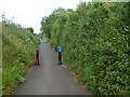
Cycle and foot route along Blackhorse Lane
Blackhorse Lane is closed to traffic, having been severed by the M5
Image: © David Smith
Taken: 22 May 2020
0.12 miles
10
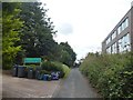
Sign for boarding kennels, near Pinhoe
The building housing the kennels first appears on maps from the 1960s; in the 2000s the area is being developed for housing estates and a science park (outpost of Exeter University opposite)
Image: © David Smith
Taken: 24 Jul 2020
0.12 miles