IMAGES TAKEN NEAR TO
AXMINSTER, EX13 5SE
Introduction
This page details the photographs taken nearby to EX13 5SE by members of the Geograph project.
The Geograph project started in 2005 with the aim of publishing, organising and preserving representative images for every square kilometre of Great Britain, Ireland and the Isle of Man.

There are currently over 7.5m images from over14,400 individuals and you can help contribute to the project by visiting https://www.geograph.org.uk
Image Map
Images are licensed for reuse under creativecommons.org/licenses/by-sa/2.0
Notes
- Clicking on the map will re-center to the selected point.
- The higher the marker number, the further away the image location is from the centre of the postcode.
Image Listing (14 Images Found)
Images are licensed for reuse under creativecommons.org/licenses/by-sa/2.0
Image
Details
Distance
1
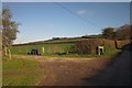
Entrance to Shiles Farm
The farm track leaves Stammery Hill; see Image
Image: © Derek Harper
Taken: 23 Nov 2013
0.11 miles
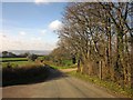
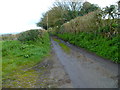
2
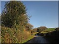
Stammery Hill
Further east along the lane shown in Image], here approaching the turning on the left into Shiles Farm.
Image: © Derek Harper
Taken: 23 Nov 2013
0.11 miles
4
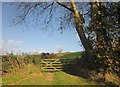
Gate by Stammery Hill
The gate is not quite visible at the start of the line of trees up the hill shown in Image
Image: © Derek Harper
Taken: 23 Nov 2013
0.14 miles
5
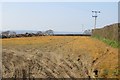
Herbicide
Some fields beside the Stammary Hill road had been treated with Roundup or something similar.
Image: © Richard Webb
Taken: 8 Apr 2015
0.14 miles
6
Stammery Hill
A reverse view of Image], with Axminster Bridleway 9 on the immediate left, leading to Beavor Grange, and the turn on the right to Payne's Place Farm.
Image: © Derek Harper
Taken: 23 Nov 2013
0.14 miles
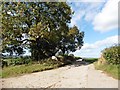
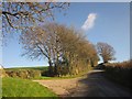
7

Stammery Hill
The principal part of the hill can be seen ahead.
Image: © Derek Harper
Taken: 23 Nov 2013
0.16 miles
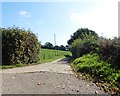
8
Stammery Hill
The turn on the left leads to Payne's Place Farm. Just ahead on the right, Axminster Bridleway 9 leaves on the right.
Image: © Derek Harper
Taken: 23 Nov 2013
0.16 miles
10
Orange Way in Devon and Torbay (507)
At the east end of Evil Lane the Orange Way turns left onto Cuthays Lane.
Image: © Shazz
Taken: 20 Apr 2012
0.21 miles