1
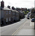
Lea Combe, Axminster
Lea Combe is a suburban road west of the Lyme Close and Fosseway Close junction.
Image: © Jaggery
Taken: 9 Mar 2017
0.12 miles
2
Bend in Lyme Close, Axminster
Ahead for Lea Combe and Fosseway Close. The Phillips Court junction is on the left.
Behind the camera for Axminster Fire Station https://www.geograph.org.uk/photo/5306661 and the B3261 Lyme Road.
Image: © Jaggery
Taken: 9 Mar 2017
0.13 miles
3
Benchmark on #15 Hillhead Terrace, Musbury Road
Ordnance Survey cut mark benchmark described on the Bench Mark Database at http://www.bench-marks.org.uk/bm45531
Image: © Roger Templeman
Taken: 20 Sep 2012
0.14 miles
4
#15 Hillhead Terrace, Musbury Road
There is an OS benchmark
Image cut in the bricks to the right of the door
Image: © Roger Templeman
Taken: 20 Sep 2012
0.14 miles
5
Lyme Close electricity substation, Axminster
The Western Power Distribution electricity substation, identifier 252454,
is behind locked wooden doors on the north side of Lyme Close.
Image: © Jaggery
Taken: 9 Mar 2017
0.14 miles
6
Musbury Road, Axminster
This part of Musbury Road, heading away from the town centre, is unclassified.
Out of shot, at the King Edward Road junction, Musbury Road becomes the A358 Musbury Road.
Image: © Jaggery
Taken: 9 Mar 2017
0.14 miles
7
Phillips Court, Axminster
Cul-de-sac on the southeast side of Lyme Close.
Image: © Jaggery
Taken: 9 Mar 2017
0.14 miles
8
Penny's Terrace, Musbury Road
There is an OS benchmark
Image on the front corner of the nearest house by the black downpipe next to its metal side gate
Image: © Roger Templeman
Taken: 20 Sep 2012
0.16 miles
9
Benchmark on #7 Penny's Terrace, Musbury Road
Ordnance Survey cut mark benchmark described on the Bench Mark Database at http://www.bench-marks.org.uk/bm45532
Image: © Roger Templeman
Taken: 20 Sep 2012
0.16 miles
10
Long Ragg Court, Lyme Close, Axminster
Flats near Axminster Community Fire Station. http://www.geograph.org.uk/photo/5306661
Image: © Jaggery
Taken: 9 Mar 2017
0.16 miles


