
IMAGES TAKEN NEAR TO
Couchill Lane, SEATON, EX12 2JH
Introduction
This page details the photographs taken nearby to Couchill Lane, EX12 2JH by members of the Geograph project.
The Geograph project started in 2005 with the aim of publishing, organising and preserving representative images for every square kilometre of Great Britain, Ireland and the Isle of Man.

There are currently over 7.5m images from over14,400 individuals and you can help contribute to the project by visiting https://www.geograph.org.uk
Image Map
Images are licensed for reuse under creativecommons.org/licenses/by-sa/2.0
Notes
- Clicking on the map will re-center to the selected point.
- The higher the marker number, the further away the image location is from the centre of the postcode.
Image Listing (20 Images Found)
Images are licensed for reuse under creativecommons.org/licenses/by-sa/2.0
Image
Details
Distance
1

Telegraph line through Couchill Wood
As shown in Image, the line of poles being followed by Beer Footpath 30 in Image continues along the contour of the hillside, but the map suggests that the path turns right here to climb once more through the woods, though there's no waymarking that I could see.
Image: © Derek Harper
Taken: 19 Jun 2012
0.10 miles
2
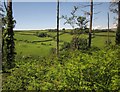
View from Couchill Woods
From the track junction shown in Image, a glimpse through the trees and over the bracken across the Beer Brook valley.
Image: © Derek Harper
Taken: 19 Jun 2012
0.10 miles
3
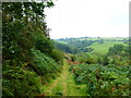
Channel to Channel (8)
Here's a look back down the track and over the valley through which Beer Brook flows.
Image: © Shazz
Taken: 14 Sep 2014
0.12 miles
4
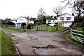
Houses in Couchill Rd
These are the last few houses at the very top of the road.
Image: © Nigel Mykura
Taken: 6 Mar 2020
0.14 miles

6

Channel to Channel (7)
The public footpath goes ahead steeply. The guide book recommends a gentle detour to the left.
Image: © Shazz
Taken: 14 Sep 2014
0.14 miles
7

Footpath near Couchill
Beer Footpath 30 is not well waymarked, but there's not much doubt about its route, climbing steeply alongside this telegraph line up through woodland on Couchill Common from the Beer Brook valley.
Image: © Derek Harper
Taken: 19 Jun 2012
0.15 miles
8
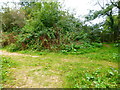
Channel to Channel (9)
The route meets this crossing of ways near the west end of Churston Rise.
Image: © Shazz
Taken: 14 Sep 2014
0.15 miles
10
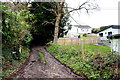
Footpath in Seaton
This is the start of the footpath on Couchill Lane. The houses beyond are in Churston Rise. The footpath soon joins another path that runs from the Beer Rd up to Seaton Down Hill.
Image: © Nigel Mykura
Taken: 6 Mar 2020
0.17 miles