
IMAGES TAKEN NEAR TO
Potters Road, BARNET, EN5 5HR
Introduction
This page details the photographs taken nearby to Potters Road, EN5 5HR by members of the Geograph project.
The Geograph project started in 2005 with the aim of publishing, organising and preserving representative images for every square kilometre of Great Britain, Ireland and the Isle of Man.

There are currently over 7.5m images from over14,400 individuals and you can help contribute to the project by visiting https://www.geograph.org.uk
Image Map
Images are licensed for reuse under creativecommons.org/licenses/by-sa/2.0
Notes
- Clicking on the map will re-center to the selected point.
- The higher the marker number, the further away the image location is from the centre of the postcode.
Image Listing (36 Images Found)
Images are licensed for reuse under creativecommons.org/licenses/by-sa/2.0
Image
Details
Distance
1
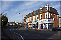
Potters Road
A small parade of shops at the junction with Cromer Road.
Image: © Martin Addison
Taken: 21 Nov 2008
0.06 miles
2
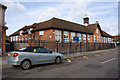
Cromer Road Primary School
The Hertfordshire coat of arms adorns the centre of the facade.
Image: © Martin Addison
Taken: 21 Nov 2008
0.09 miles
3
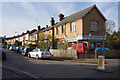
Bulwer Road
Seen from the junction with Plantagenet Road. The corner shop, number 54a, has clearly not served in that function for many years and the forecourt has become a repository for dead vehicles. The faded paint work above the window suggests that it may once have been a newsagent.
Image: © Martin Addison
Taken: 21 Nov 2008
0.09 miles
5
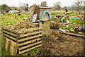
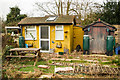
Clifford Road Allotments
Ready for spring
Image: © Hugh Close
Taken: 6 Mar 2013
0.10 miles
6
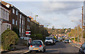
Hadley Road
Seen from The Bulwer Road end. The road dips down to meet Potters Road before climbing to Hadley Common, the trees of which are visible in the distance.
Image: © Martin Addison
Taken: 21 Nov 2008
0.11 miles

10
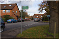
Boleyn Way
Looking into this housing estate on the end of Cromer Road. Cromer Road itself has been extended on the right to form a mini-estate. The sign indicates the footpath to Victoria Recreation Ground.
Image: © Martin Addison
Taken: 21 Nov 2008
0.14 miles