
IMAGES TAKEN NEAR TO
Wrotham Road, BARNET, EN5 4LE
Introduction
This page details the photographs taken nearby to Wrotham Road, EN5 4LE by members of the Geograph project.
The Geograph project started in 2005 with the aim of publishing, organising and preserving representative images for every square kilometre of Great Britain, Ireland and the Isle of Man.

There are currently over 7.5m images from over14,400 individuals and you can help contribute to the project by visiting https://www.geograph.org.uk
Image Map
Images are licensed for reuse under creativecommons.org/licenses/by-sa/2.0
Notes
- Clicking on the map will re-center to the selected point.
- The higher the marker number, the further away the image location is from the centre of the postcode.
Image Listing (120 Images Found)
Images are licensed for reuse under creativecommons.org/licenses/by-sa/2.0
Image
Details
Distance
1
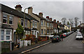
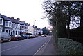
Wrotham Road
A short road connecting Falklands Road with St. Albans Road. The ground slopes away quite steeply to the left of this photo and the houses on this side of the road are significantly lower than those on the other. It's also quite a climb up the road.
Image: © Martin Addison
Taken: 8 Nov 2009
0.01 miles
2
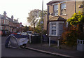
Corner of Wrotham Road and Falkland Road
Image: © David Howard
Taken: 25 Oct 2011
0.01 miles
3
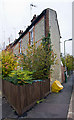
End of Terrace
An interesting end to the terrace on Wrotham Road. The junction with Falkland Road is quite an acute angle and the builders of this house have mirrored it. I would guess that the rooms at this end are triangular, which must make decorating interesting!
Image: © Martin Addison
Taken: 8 Nov 2009
0.02 miles
6
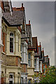
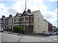
Housing on St. Albans Road
Detail of terraced housing opposite Christ Church. There are detail differences in the roof line with some houses retaining finials and some not. one house has had its slates replaced by tiles. The furthest two houses are of a different design to the others, featuring brick bay windows instead of the stone moldings used on the others, and different finials on the roof.
Image: © Martin Addison
Taken: 8 Nov 2009
0.05 miles
7
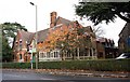
Building to the north of Christ Church, Barnet, Herts
Image: © John Salmon
Taken: 16 Nov 2009
0.06 miles
8
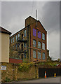
Alston Works
Seen from Falkland Road. This was once the factory of The Dental Manufacturing Company Ltd. Now it is offices and a gym.
In 1901 the managing director of the company set up a football club for the employees, Alston Works Athletic FC. The club merged with Barnet Avenue FC in 1912 to become Barnet & Alston FC and founder members of the Athenian League. Subsequently they became Barnet FC, currently in the 2nd division of the Football League. The full story can be found at http://www.historicalkits.co.uk/Barnet/Barnet.htm
Image: © Martin Addison
Taken: 8 Nov 2009
0.07 miles
9
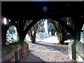
Entrance to cemetery, St Alban's Road, Barnet
Image: © Bikeboy
Taken: 19 Jan 2014
0.07 miles
10
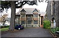
Building to north of Christ Church, Barnet, Herts
Image: © John Salmon
Taken: 16 Nov 2009
0.07 miles