
IMAGES TAKEN NEAR TO
Stoneleigh Avenue, ENFIELD, EN1 4HL
Introduction
This page details the photographs taken nearby to Stoneleigh Avenue, EN1 4HL by members of the Geograph project.
The Geograph project started in 2005 with the aim of publishing, organising and preserving representative images for every square kilometre of Great Britain, Ireland and the Isle of Man.

There are currently over 7.5m images from over14,400 individuals and you can help contribute to the project by visiting https://www.geograph.org.uk
Image Map
Images are licensed for reuse under creativecommons.org/licenses/by-sa/2.0
Notes
- Clicking on the map will re-center to the selected point.
- The higher the marker number, the further away the image location is from the centre of the postcode.
Image Listing (14 Images Found)
Images are licensed for reuse under creativecommons.org/licenses/by-sa/2.0
Image
Details
Distance
1
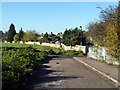
The end of Palmers Lane
At least for cars, etc, and there is hardly any provision for turning round. The route continues as a footpath, and there is a foot and cycle way on the right to Stoneleigh Avenue.
Image: © Robin Webster
Taken: 11 Nov 2012
0.07 miles
2
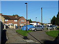
Stoneleigh Avenue
Viewed from the footway at the end of Palmers Lane.
Image: © Robin Webster
Taken: 11 Nov 2012
0.07 miles
3
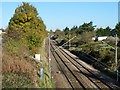
Railway north of Palmers Lane bridge
The Hackney Downs and Cheshunt (via Turkey Street) Line, with Turkey Street the next station in this direction.
Image: © Robin Webster
Taken: 11 Nov 2012
0.13 miles
4
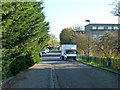
Palmers Lane
Looking down from the bridge over the railway.
Image: © Robin Webster
Taken: 11 Nov 2012
0.14 miles
5
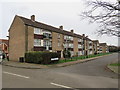
Block of flats on Carterhatch Lane, near Enfield
A low-rise block of flats on Carterhatch Lane near Enfield, in the outer suburbs of north London.
Image: © Malc McDonald
Taken: 22 Feb 2020
0.18 miles
6
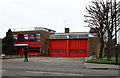
Enfield Fire Station
Located on Carterhatch Lane.
Image: © Martin Addison
Taken: 12 Feb 2011
0.19 miles
7
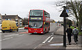
Carterhatch Lane
Seen at the junction with Bridge Close. A 191 bus operated by First descends from the bridge over the Southbury Loop line on its way to Edmonton from Brimsdown. The vehicle is an Alexander Dennis Enviro 400.
The pedestrians on this side of the road are fans of Wingate & Finchley football club doing a charity walk from the Abrahams Stadium to Waltham Abbey's Capershotts ground. I was taking part, so after getting the photo it was time to catch up!
Image: © Martin Addison
Taken: 12 Feb 2011
0.20 miles
8
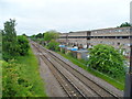
Railway line between Turkey St and Southbury stations
Image: © Bikeboy
Taken: 9 Jun 2013
0.21 miles
9
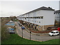
Lawson Road, near Enfield
The Lytchet Way housing estate near Enfield, in the outer suburbs of north London.
Image: © Malc McDonald
Taken: 22 Feb 2020
0.21 miles
10
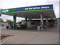
Applegreen petrol station, Enfield
Petrol Station on the A10 Great Cambridge Road
Image: © Oxyman
Taken: 19 Oct 2008
0.21 miles