
IMAGES TAKEN NEAR TO
Langton Avenue, LIVINGSTON, EH53 0DR
Introduction
This page details the photographs taken nearby to Langton Avenue, EH53 0DR by members of the Geograph project.
The Geograph project started in 2005 with the aim of publishing, organising and preserving representative images for every square kilometre of Great Britain, Ireland and the Isle of Man.

There are currently over 7.5m images from over14,400 individuals and you can help contribute to the project by visiting https://www.geograph.org.uk
Image Map
Images are licensed for reuse under creativecommons.org/licenses/by-sa/2.0
Notes
- Clicking on the map will re-center to the selected point.
- The higher the marker number, the further away the image location is from the centre of the postcode.
Image Listing (23 Images Found)
Images are licensed for reuse under creativecommons.org/licenses/by-sa/2.0
Image
Details
Distance
1
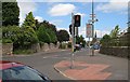
East Calder
Road junction in East Calder
Image: © Richard Webb
Taken: 22 Jul 2008
0.09 miles
2
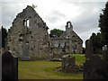
St Cuthbert's Kirk East Calder
16th century church abandoned in 1750 when the parish was united with Kirknewton.
Image: © Jim Smillie
Taken: 9 Jul 2009
0.09 miles
3
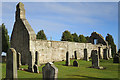
St Cuthbert's Parish Kirk
The original door has been walled up, and part of the south wall replaced by more modern blocks.
Image: © Anne Burgess
Taken: 21 Feb 2018
0.09 miles
4
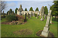
St Cuthbert's Parish Kirk
The 16th century kirk, with 17th century bellcote, has been disused since the union of East Calder with Kirknewton in 1750.
Image: © Anne Burgess
Taken: 21 Feb 2018
0.09 miles
5
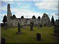
Graveyard St Cuthbert's
Some rather ornate carvings on some gravestones dating from 17th and 18th centuries.
Image: © Jim Smillie
Taken: 9 Jul 2009
0.10 miles
6

St Cuthbert's Parish Kirk
After it became disused in 1750, the kirk was divided into three burial enclosures.
Image: © Anne Burgess
Taken: 21 Feb 2018
0.10 miles
7

Main Street
On the right is the spire of the present East Calder and Kirknewton Parish Kirk, which was originally a United Presbyterian kirk, built in 1886. The hideous and garish modern supermarket is a blot on the otherwise 19th century street.
Image: © Anne Burgess
Taken: 21 Feb 2018
0.10 miles
8
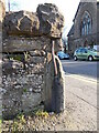
Old milestone
This is the left-hand side of the upside down, broken Calder District milestone outside 190 Main Street, East Calder. The metal strap is holding the broken pieces together. Edinburgh 11/Glasgow 31 would have been painted on the front face now at ground level with the large rough top piece set into the ground.
Image: © John Riddell
Taken: 6 Mar 2021
0.11 miles
9
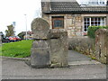
Old milestone
This very weathered stone is outside 190 Main Street, East Calder. Another stone on one of the Calder Trust tollroads on the Wishaw r. It may be upside down and have had Glasgow 31 painted on the raised band, now at the base.
Image: © John Riddell
Taken: 14 Oct 2017
0.11 miles
10
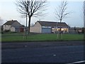
Convenience Store
James Miller Convenience Store, conveniently situated in East Calder.
Image: © Callum Black
Taken: 12 Dec 2005
0.12 miles