
IMAGES TAKEN NEAR TO
Balmuir Avenue, BATHGATE, EH48 4BW
Introduction
This page details the photographs taken nearby to Balmuir Avenue, EH48 4BW by members of the Geograph project.
The Geograph project started in 2005 with the aim of publishing, organising and preserving representative images for every square kilometre of Great Britain, Ireland and the Isle of Man.

There are currently over 7.5m images from over14,400 individuals and you can help contribute to the project by visiting https://www.geograph.org.uk
Image Map
Images are licensed for reuse under creativecommons.org/licenses/by-sa/2.0
Notes
- Clicking on the map will re-center to the selected point.
- The higher the marker number, the further away the image location is from the centre of the postcode.
Image Listing (7 Images Found)
Images are licensed for reuse under creativecommons.org/licenses/by-sa/2.0
Image
Details
Distance
1
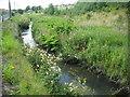
Bathgate Water
Running alongside Balmuir Road.
Image: © Jim Smillie
Taken: 29 Jul 2010
0.09 miles
2
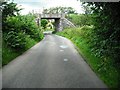
Bridge over Race Road
This carried a line identified on a 19thC map as Blackston to Boghead Branch of the Monkland Railway.
Image: © Jim Smillie
Taken: 29 Jul 2010
0.21 miles
3
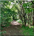
Woodland path: Belvedere Wood
On northwest outskirts of Bathgate
Image: © Jim Smillie
Taken: 1 Jun 2021
0.21 miles
4
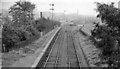
Bathgate Lower Station -- remains
View SE, towards Bathgate Upper. The station, on the branch to Bathgate Upper from Blackstone Junction on the Monklands Railway (Kirkintilloch - Causewayend), had been closed to passengers on 1/5/30, but Bathgate Lower remained open for Goods until 28/10/63 and the line was still used from Blackstone Junction until 1/5/67 and to Bathgate Upper until as late as 3/9/73. This explains the shiny rails in this picture taken in September 1962.
Image: © Ben Brooksbank
Taken: 19 Sep 1962
0.22 miles
5
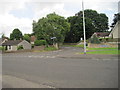
Bathgate Lower railway station (site)
Opened in 1856 as a branch from the Monkland Railways' line at Blackstone, this station closed to passengers as early as 1930, and closed completely in 1963.
View south east across the former level crossing, with the platforms being somewhere near the course of the minor road opposite. The main building was somewhere near where the tree in the centre of the image is. As can be seen, no trace appears to remain.
Image: © Nigel Thompson
Taken: 5 Jul 2014
0.22 miles
6

Railway bridge over Race Road
With no longer any sign of the railway on either side.
Image: © M J Richardson
Taken: 25 Feb 2020
0.23 miles
7

Flats at Jardine Place, Bathgate
An apartment block adjacent to a small development of detached houses on the northwest extremity of Bathgate.
Image: © M J Richardson
Taken: 25 Feb 2020
0.24 miles