Bathgate Lower Station -- remains
Introduction
The photograph on this page of Bathgate Lower Station -- remains by Ben Brooksbank as part of the Geograph project.
The Geograph project started in 2005 with the aim of publishing, organising and preserving representative images for every square kilometre of Great Britain, Ireland and the Isle of Man.

There are currently over 7.5m images from over 14,400 individuals and you can help contribute to the project by visiting https://www.geograph.org.uk
Bathgate Lower Station -- remains
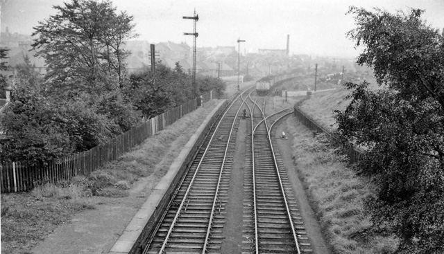
Image: © Ben Brooksbank Taken: 19 Sep 1962
View SE, towards Bathgate Upper. The station, on the branch to Bathgate Upper from Blackstone Junction on the Monklands Railway (Kirkintilloch - Causewayend), had been closed to passengers on 1/5/30, but Bathgate Lower remained open for Goods until 28/10/63 and the line was still used from Blackstone Junction until 1/5/67 and to Bathgate Upper until as late as 3/9/73. This explains the shiny rails in this picture taken in September 1962.
Images are licensed for reuse under creativecommons.org/licenses/by-sa/2.0
Image Location
Latitude
55.904379
Longitude
-3.650637