IMAGES TAKEN NEAR TO
Swaton Road, LONDON, E3 4ES
Introduction
This page details the photographs taken nearby to Swaton Road, E3 4ES by members of the Geograph project.
The Geograph project started in 2005 with the aim of publishing, organising and preserving representative images for every square kilometre of Great Britain, Ireland and the Isle of Man.

There are currently over 7.5m images from over14,400 individuals and you can help contribute to the project by visiting https://www.geograph.org.uk
Image Map (68 Images)


Leaflet Map data © OpenStreetMap
Images are licensed for reuse under creativecommons.org/licenses/by-sa/2.0
Notes
- Clicking on the map will re-center to the selected point.
- The higher the marker number, the further away the image location is from the centre of the postcode.
Image Listing (68 Images Found)
Images are licensed for reuse under creativecommons.org/licenses/by-sa/2.0
Image
Details
Distance
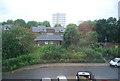
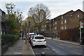
3
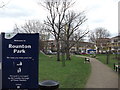
Rounton Park, Bow
This small rectangular park is between Campbell Road and Rounton Road.
Image: © David Anstiss
Taken: 15 Feb 2012
0.07 miles
5
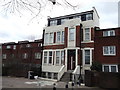
Former Bow Library
This former converted library is near Campbell Road.
It has now been converted into a large private house.
Image: © David Anstiss
Taken: 15 Feb 2012
0.08 miles
6
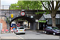
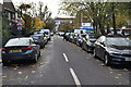
Rounton Road
Low railway bridges cross this narrow side street in Bromley. The closest carries the Fenchurch Street to Shoeburyness line whilst the other carries the District Line to Barking and Upminster. Nestling between, behind the blue screens, is a Crossrail bore to the construction works beneath - difficult for the trucks to access I should think.
Image: © Martin Addison
Taken: 15 May 2015
0.09 miles
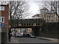
8
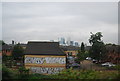
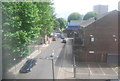
Railway bridge on Rounton Road
Rounton Road leads from Knapp Road to Campbell Road.
It passes under the railway between Limehouse and Bromley-by-Road.
In the background is another railway bridge leading between Bromley-by-Road and Bow Road. See Image
Image: © David Anstiss
Taken: 15 Feb 2012
0.10 miles
10
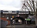
Railway bridge on Campbell Road
Campbell Road leads towards Bow Road.
It leads under the railway between Bromley-le-Bow and Bow Road stations.
Image: © David Anstiss
Taken: 15 Feb 2012
0.11 miles