Rounton Road
Introduction
The photograph on this page of Rounton Road by Martin Addison as part of the Geograph project.
The Geograph project started in 2005 with the aim of publishing, organising and preserving representative images for every square kilometre of Great Britain, Ireland and the Isle of Man.

There are currently over 7.5m images from over 14,400 individuals and you can help contribute to the project by visiting https://www.geograph.org.uk
Rounton Road
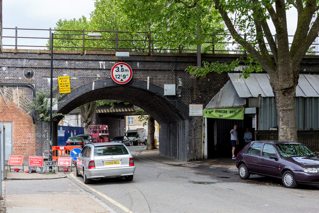
Image: © Martin Addison Taken: 15 May 2015
Low railway bridges cross this narrow side street in Bromley. The closest carries the Fenchurch Street to Shoeburyness line whilst the other carries the District Line to Barking and Upminster. Nestling between, behind the blue screens, is a Crossrail bore to the construction works beneath - difficult for the trucks to access I should think.
Images are licensed for reuse under creativecommons.org/licenses/by-sa/2.0
Image Location
Latitude
51.524435
Longitude
-0.020695