1
The Bridge House, Bow
Closed public house on Bow Common Lane, leading towards Limehouse Cut (canal).
Beside a large block of modern apartments beside the canal.
Image: © David Anstiss
Taken: 15 Feb 2012
0.04 miles
2
Thomas Road Bow Common East London. 1956
He took the corner just a bit too fast.
Image: © Derek Voller
Taken: 3 May 1956
0.04 miles
3
Vietnamese Catholic Church, Bow
Large church on the junction of St Paul's Way (on the right) and Bow Common Lane (on the left).
Image: © David Anstiss
Taken: 15 Feb 2012
0.06 miles
4
Old Boundary Marker by the B140, St Paul's Way, Poplar
Parish Boundary Marker by the B140, in parish of Poplar (Tower Hamlets District), St Paul's Way E3, near junction with Bow Common Lane, set in wall of RC church above MX_SAL02pb
Image
Surveyed
Milestone Society National ID: MX_SAL01pb
Image: © Milestone Society
Taken: Unknown
0.06 miles
5
Old Boundary Marker by the B140, St Paul's Way, Poplar
Parish Boundary Marker by the B140, in parish of Poplar (Tower Hamlets District), St Paul's Way E3, near junction with Bow Common Lane, wall of RC church below MX_SAL01pb
Image
Surveyed
Milestone Society National ID: MX_SAL02pb
Image: © Milestone Society
Taken: Unknown
0.06 miles
6
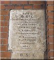
Old Boundary Marker by the B160, St Paul's Way, Poplar Parish
Parish Boundary Marker by the B140, in parish of Poplar (Tower Hamlets District), St Paul's Way E3, junction of Bow Common Lane, on wall of RC church, above MX_BSL06pb
Image
Surveyed
Milestone Society National ID: MX_BSL05pb
Image: © Milestone Society
Taken: Unknown
0.06 miles
7
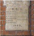
Old Boundary Marker by the B140, St Paul's Way, Poplar Parish
Parish Boundary Marker by the B140, in parish of Poplar (Tower Hamlets District), St Paul's Way E3, junction with Bow Common Lane, on wall of RC church below MX_BSL05pb
Image
Surveyed
Milestone Society National ID: MX_BSL06pb
Image: © Milestone Society
Taken: Unknown
0.06 miles
8
Bow Common, from the air
In the foreground, Limehouse Cut runs along the front of a housing estate; in the background, just visible, the curving railway lines joining the Fenchurch Street lines to those out of Liverpool Street, and in the top left the corner of Tower Hamlets cemetery.
Taken from the approach to London City Airport, photographer's position conjectural.
Image: © Christopher Hilton
Taken: 13 Dec 2012
0.08 miles
9
Bow, St Pauls Way Trust School
The main entrance, on St Pauls Way. http://www.spwt.net/default.htm
Image: © Mike Faherty
Taken: 26 Aug 2012
0.08 miles
10
Furze Green and Hawgood Street, London E3
From the 1860s to the 2nd World War this area was densely covered in small houses. Since then it has been totally redeveloped with a green space surrounded by apartments. The new financial district towers of Canary Wharf, seen mistily behind Hawgood Street, have changed the area even more.
Image: © David Hawgood
Taken: 10 Oct 2015
0.08 miles


