Bow Common, from the air
Introduction
The photograph on this page of Bow Common, from the air by Christopher Hilton as part of the Geograph project.
The Geograph project started in 2005 with the aim of publishing, organising and preserving representative images for every square kilometre of Great Britain, Ireland and the Isle of Man.

There are currently over 7.5m images from over 14,400 individuals and you can help contribute to the project by visiting https://www.geograph.org.uk
Bow Common, from the air
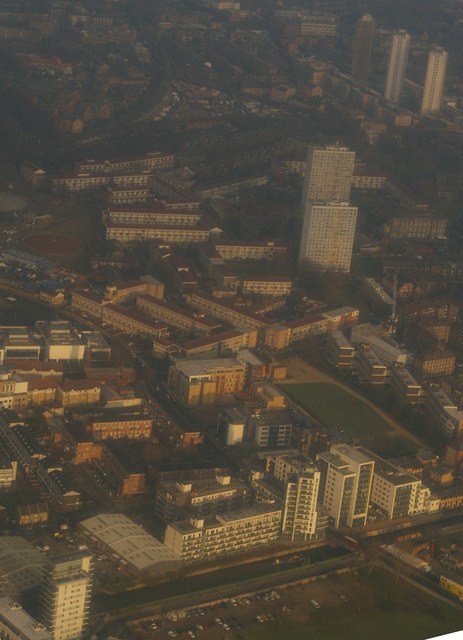
Image: © Christopher Hilton Taken: 13 Dec 2012
In the foreground, Limehouse Cut runs along the front of a housing estate; in the background, just visible, the curving railway lines joining the Fenchurch Street lines to those out of Liverpool Street, and in the top left the corner of Tower Hamlets cemetery. Taken from the approach to London City Airport, photographer's position conjectural.
Images are licensed for reuse under creativecommons.org/licenses/by-sa/2.0
Image Location
Latitude
51.516476
Longitude
-0.023347