IMAGES TAKEN NEAR TO
Railway Arches, Poyser Street, LONDON, E2 9RF
Introduction
This page details the photographs taken nearby to Railway Arches, Poyser Street, E2 9RF by members of the Geograph project.
The Geograph project started in 2005 with the aim of publishing, organising and preserving representative images for every square kilometre of Great Britain, Ireland and the Isle of Man.

There are currently over 7.5m images from over14,400 individuals and you can help contribute to the project by visiting https://www.geograph.org.uk
Image Map
Images are licensed for reuse under creativecommons.org/licenses/by-sa/2.0
Notes
- Clicking on the map will re-center to the selected point.
- The higher the marker number, the further away the image location is from the centre of the postcode.
Image Listing (143 Images Found)
Images are licensed for reuse under creativecommons.org/licenses/by-sa/2.0
Image
Details
Distance
1
Victorian Terraced Houses, East London
These houses are in Portree St, London E14
Image: © Nigel Mykura
Taken: 12 Jan 2008
0.03 miles
2
View of the Gherkin from the A13
Looking west-northwest.
Image: © Robert Lamb
Taken: 8 May 2011
0.03 miles
3
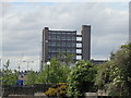
Towerblock alongside the Blackwall Tunnel Northern Approach, viewed from the Bow Creek Ecology Park path
Does this tower block remind you of something else? Yes, you're right, it is very similar to Trellick Tower in Ladbroke Grove, featured in Image It is just inside the right hand edge of the adjacent gridsquare to the left of this one, TQ3881. Looking west.
Image: © Robert Lamb
Taken: 8 May 2011
0.05 miles
4
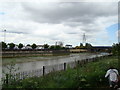
New towerblocks alongside the A13
Looking northwest.
Image: © Robert Lamb
Taken: 8 May 2011
0.06 miles
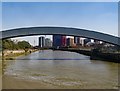
6
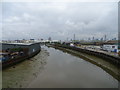
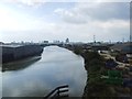
River Lea
The River Lea rises in the Chiltern Hills and flows south east through east London where it joins the River Thames.
View north west from the bridge on the A13.
Image: © JThomas
Taken: 11 May 2019
0.09 miles
7
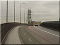
A13, Canning Town
Part of the road system crossing the River Lee from South Bromley into Cannin Town.
Image: © Derek Harper
Taken: 12 Jan 2011
0.09 miles
8
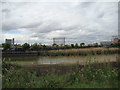
Gas holder on Abbott Road, looking west-southwest from the Bow Creek Ecology Park path
Looking west-southwest.
Image: © Robert Lamb
Taken: 8 May 2011
0.10 miles