
IMAGES TAKEN NEAR TO
Kingsland Road, LONDON, E2 8EB
Introduction
This page details the photographs taken nearby to Kingsland Road, E2 8EB by members of the Geograph project.
The Geograph project started in 2005 with the aim of publishing, organising and preserving representative images for every square kilometre of Great Britain, Ireland and the Isle of Man.

There are currently over 7.5m images from over14,400 individuals and you can help contribute to the project by visiting https://www.geograph.org.uk
Image Map
Images are licensed for reuse under creativecommons.org/licenses/by-sa/2.0
Notes
- Clicking on the map will re-center to the selected point.
- The higher the marker number, the further away the image location is from the centre of the postcode.
Image Listing (440 Images Found)
Images are licensed for reuse under creativecommons.org/licenses/by-sa/2.0
Image
Details
Distance
2
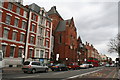
Haggerston: St. Columba's Church, Kingsland Road
This large church was built in 1867-1869. It became disused by the Church of England in 1979, but has been taken over by the 'Christ Apostolic Church'.
Image: © Dr Neil Clifton
Taken: 9 Mar 2011
0.02 miles
4
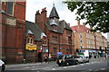
St. Columba's Church, Kingsland Road, London
Now this has become the 'Christ Apostolic Church'.
Image: © Dr Neil Clifton
Taken: 19 Jul 2007
0.02 miles
5
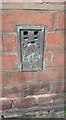
Ordnance Survey Flush Bracket (S0543)
This OS Flush Bracket can be found on the east face of St Columba's Church. It marks a point 19.834m above mean sea level.
Image: © Adrian Dust
Taken: 16 Aug 2016
0.03 miles
6
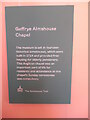
Information Notice in the Museum of the Home
This notice is by the Geffrye Almshouse Chapel and has the following wording:
Geffrye Almshouse
Chapel
The museum is set in fourteen
historical almshouses, which were
built in 1714 and provided free
housing for elderly pensioners.
This Anglican chapel was an
important part of life for
residents and attendance at the
Chapel's Sunday ceremonies
was compulsory.
The Almshouse Trail
Image: © David Hillas
Taken: 19 Jan 2023
0.03 miles
7
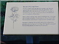
Information Board at the Gardens through Time
This information board is located in the 'Gardens through Time' behind the Museum of the Home. It has the following wording:
Gardens Through Time
From a Tudor knot garden to a green roof, the six
spaces laid out here show how city gardens have
developed over the centuries. They echo changes in
society and the wider world, and show the fashions
and innovations of the time.
Many urban homes only have a small garden, if one at
all, so they are often multipurpose spaces that fulfil
the practical and leisure requirements of their user.
However, whether for profit, pleasure or function,
gardens can be kept to creating a feeling of home and
connecting people to their environment.
Image: © David Hillas
Taken: 19 Jan 2023
0.03 miles
8
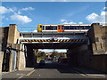
How's Street bridge, Hoxton
How's Street passes below a railway bridge. The bridge carries a section of the London Overground network through this part of inner east London. In front of the bridge is a sacrificial beam, protecting the bridge from being hit by overheight vehicles. The road sign indicates that vehicles taller than 4.6 metres (15 feet) are prohibited from attempting to pass under the bridge.
The railway was built in the early 1860s, closing in 1986. It was reopened in 2010.
Image: © Malc McDonald
Taken: 3 Nov 2018
0.03 miles
9
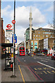
Kingsland Road
Looking north across the junction with Nuttall Street and Whiston Road towards the Süleymaniye Mosque.
Image: © Martin Addison
Taken: 19 Feb 2014
0.04 miles
10
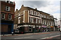
The 'King's Head', Kingsland Road, London
In an era that has brought many people of different religions to this area, it has not always been easy for public houses to survive, as some of these religions forbid the consumption of alcohol. A number of buildings which clearly used to be public houses can be seen. But the King's Head, thankfully, has survived as a no-nonsense pub where you can still get a pint of good beer and a bite to eat as well, should you so desire. But that peaceful cigar or pipe is now a thing of the past.
Image: © Dr Neil Clifton
Taken: 19 Jul 2007
0.04 miles