
IMAGES TAKEN NEAR TO
Old Bethnal Green Road, LONDON, E2 6QA
Introduction
This page details the photographs taken nearby to Old Bethnal Green Road, E2 6QA by members of the Geograph project.
The Geograph project started in 2005 with the aim of publishing, organising and preserving representative images for every square kilometre of Great Britain, Ireland and the Isle of Man.

There are currently over 7.5m images from over14,400 individuals and you can help contribute to the project by visiting https://www.geograph.org.uk
Image Map
Images are licensed for reuse under creativecommons.org/licenses/by-sa/2.0
Notes
- Clicking on the map will re-center to the selected point.
- The higher the marker number, the further away the image location is from the centre of the postcode.
Image Listing (196 Images Found)
Images are licensed for reuse under creativecommons.org/licenses/by-sa/2.0
Image
Details
Distance
1
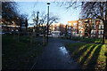
Turf Zone "Middleton"
At Middleton Green, Bethnal Green, London.
Image: © Ian S
Taken: 26 Dec 2022
0.03 miles
2
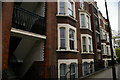
Tenement building, Old Bethnal Green Road, E2
Image: © Christopher Hilton
Taken: 18 May 2012
0.03 miles
3
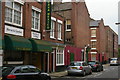
Winkley Street, E2
This street forms part of the Winkley Estate.
Image: © Christopher Hilton
Taken: 18 May 2012
0.04 miles
4
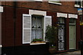
Winkley Street, E2
This street forms part of the Winkley Estate.
Image: © Christopher Hilton
Taken: 18 May 2012
0.05 miles
5
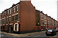
Winkley Street and Canrobert Street, E2
These two streets form part of the Winkley Estate.
Image: © Christopher Hilton
Taken: 18 May 2012
0.05 miles
6
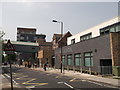
Oaklands School, Bethnal Green
On Old Bethnal Green Road.
The school has a footbridge over the road to connect two parts of the school together.
Image: © David Anstiss
Taken: 23 May 2012
0.06 miles
7
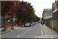
Mansford Street, E2, looking north
Taken from the corner of Old Bethnal Green Road: the Victorian buildings of Oaklands School to the right.
Image: © Christopher Hilton
Taken: 18 May 2012
0.07 miles
8
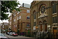
Mansford Street, E2: Unitarian chapel and Oaklands School
The Unitarian chapel (and the former manse, off the picture to the right) are occupied by the Chalice Foundation, a Unitarian charity.
The building beyond the chapel, part of Oaklands School, is linked to the original Victorian school buildings (visible in the distance) by a footbridge over Old Bethnal Green Road.
Image: © Christopher Hilton
Taken: 18 May 2012
0.08 miles
9
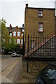
Mansford Street, E2: back of the former Unitarian manse
Off to the right is the Unitarian chapel: this, and the former manse in the centre of the picture, are now occupied by the Chalice Foundation, a Unitarian charity. Beyond the former manse is the Victorian building of Lawdale School.
For an image taken from approximately the same spot in 1988 see Image
Image: © Christopher Hilton
Taken: 18 May 2012
0.09 miles
10

Lawdale School and rear of Unitarian manse, Mansford Street E2
At the time, rooms in the manse were let to tenants to support the work of the chapel (off the image to the right). The chapel and former manse are now occupied by the Chalice Foundation, a Unitarian charity. Beyond the former manse is the Victorian building of Lawdale School.
See Image for an image from a similar location taken in 2012.
Image: © Christopher Hilton
Taken: 19 Jul 1988
0.09 miles