IMAGES TAKEN NEAR TO
Brick Lane, LONDON, E1 6RL
Introduction
This page details the photographs taken nearby to Brick Lane, E1 6RL by members of the Geograph project.
The Geograph project started in 2005 with the aim of publishing, organising and preserving representative images for every square kilometre of Great Britain, Ireland and the Isle of Man.

There are currently over 7.5m images from over14,400 individuals and you can help contribute to the project by visiting https://www.geograph.org.uk
Image Map
Images are licensed for reuse under creativecommons.org/licenses/by-sa/2.0
Notes
- Clicking on the map will re-center to the selected point.
- The higher the marker number, the further away the image location is from the centre of the postcode.
Image Listing (1273 Images Found)
Images are licensed for reuse under creativecommons.org/licenses/by-sa/2.0
Image
Details
Distance
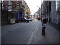
2
View of shutter art on Princelet Street
Looking north-northeast.
Image: © Robert Lamb
Taken: 23 Oct 2016
0.01 miles
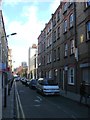
3
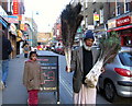
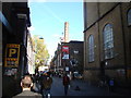
Sunday morning, Brick Lane
This man was walking briskly down the street carrying two bunches of peacock feathers: he stopped to allow me to photograph him. The area is busy on a Sunday with local residents and visitors to Spitalfields market.
Image: © Natasha Ceridwen de Chroustchoff
Taken: 21 Jan 2007
0.01 miles
5
View of the Truman Brewery chimney from Brick Lane
Looking north-northwest.
Image: © Robert Lamb
Taken: 21 Oct 2011
0.01 miles
6
The Great London Mosque in Brick Lane
On the corner of Fournier Street, this was originally founded as a church for Huguenots who fled to London to avoid persecution in France. The chapel was later used by Methodists and in the late 19th century, when Whitechapel became the centre of the Jewish East End, it became the Machzike Adass, also known as the Spitalfields Great Synagogue. With the dispersal of the Jewish community and a new influx of Bengali immigrants, it became the Jamme Masjid or Great London Mosque in 1976.
The sundial at the top is dated 1743 with the words UMBRA SUMUS above the hours.
Image: © Natasha Ceridwen de Chroustchoff
Taken: 21 Jan 2007
0.01 miles
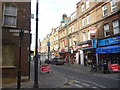
7
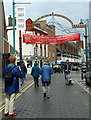
Brick Lane, Spitalfields
Fascinating area
Image: © Christine Matthews
Taken: Unknown
0.01 miles
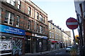
8
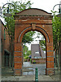
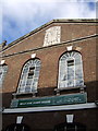
Gateway erected in 1886 by the Four Per Cent Industrial Dwelling Company Ltd.
This gateway was erected in Wentworth Street in 1886 by the Four Per Cent Industrial Dwelling Company Limited and seems to be all that remains of the original estate.
Image: © Christine Matthews
Taken: 18 May 2003
0.01 miles
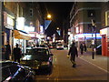
10
London Cityscape : Invisible Workforce In Brick Lane, E1
Wow! Their cloaks of invisibility are working well.
Image: © Richard West
Taken: 1 Oct 2014
0.02 miles